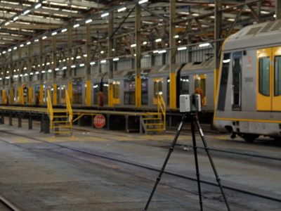
CAD & BIM

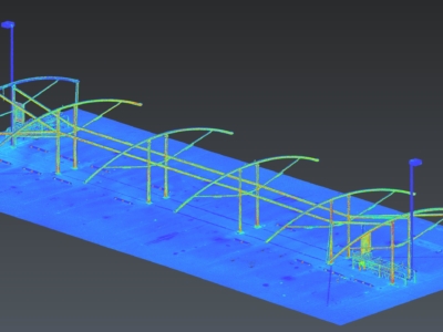
REVIT Modelling of Factory Pipes
High accuracy terrestrial laser scanning survey and scan-to-Revit modelling of ammonia piping…
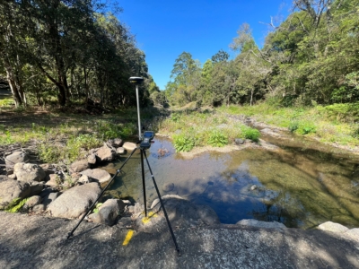
Survey Solution for Flood Recovery Works
Drone LiDAR, orthophoto, conventional survey and services location of 37no. sites to…
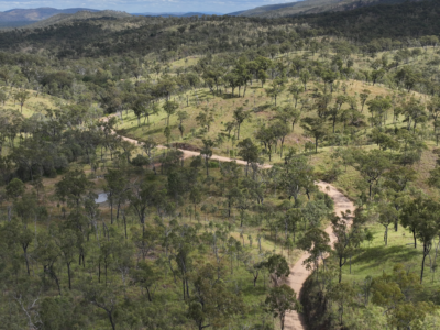
Spatial Survey for Windfarm Project
Drone LiDAR, orthophoto, terrestrial laser scanning and survey of project area and…
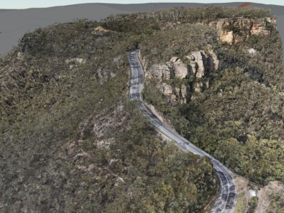
Geospatial Survey of Road Corridor
Drone LiDAR, photogrammetry modelling, terrestrial laser scanning and detail survey of road…
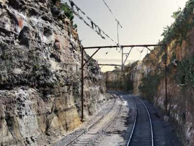
As-Built Survey of Rail Corridor for Engineering Design
High resolution drone LiDAR, photogrammetry and as-built survey of rail corridor for…
Scan-to-CAD for Fabrication Design
Terrestrial laser scanning As-Built survey of existing shade structure for detailed design…
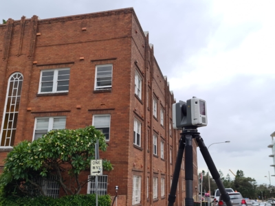
Survey of Residential Building
As-Built SURVEY AND Scan-to-Revit workflow OF RESIDENTIAL APARTMENT FOR DESIGN of remediation…
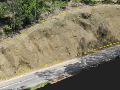
Completing the project lifecycle with As-Built surveys
Returning to sites in Victoria for as-built surveys of completed slope stabilisation…
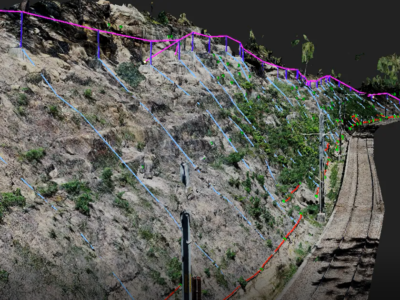
Work As Executed Survey Using Photogrammetry
A Scan-to-CAD workflow done a little bit differently – using Drone Photogrammetry…
OHL Inspection and Monitoring using Laser Scanning
Laser Scanning and drone-inspection for OHL conformance and clearance monitoring PROJECT OVERVIEW…
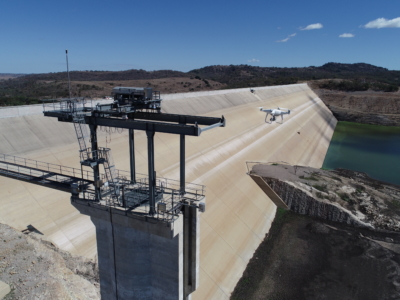
Inspection, Survey and Defect Mapping of Dam using Photogrammetry, Thermal IR and Imaging
High resolution inspection and defect mapping over more than 60,000m2 of concrete…
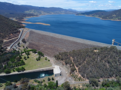
Dam Defect Mapping
Drone-based inspection, digital defect mapping and precision aerial survey for one of…