Laser Scanning
An active sensing technology which delivers very high precision, does not require GPS signal and works well in poorly lit environments. Laser scanning effectively delivers accurate and precise point clouds for complex and indoor environments. This makes it an ideal tool for engineering survey applications, architecture, industrial facilities and scan-to-CAD or scan-to-Revit workflows.
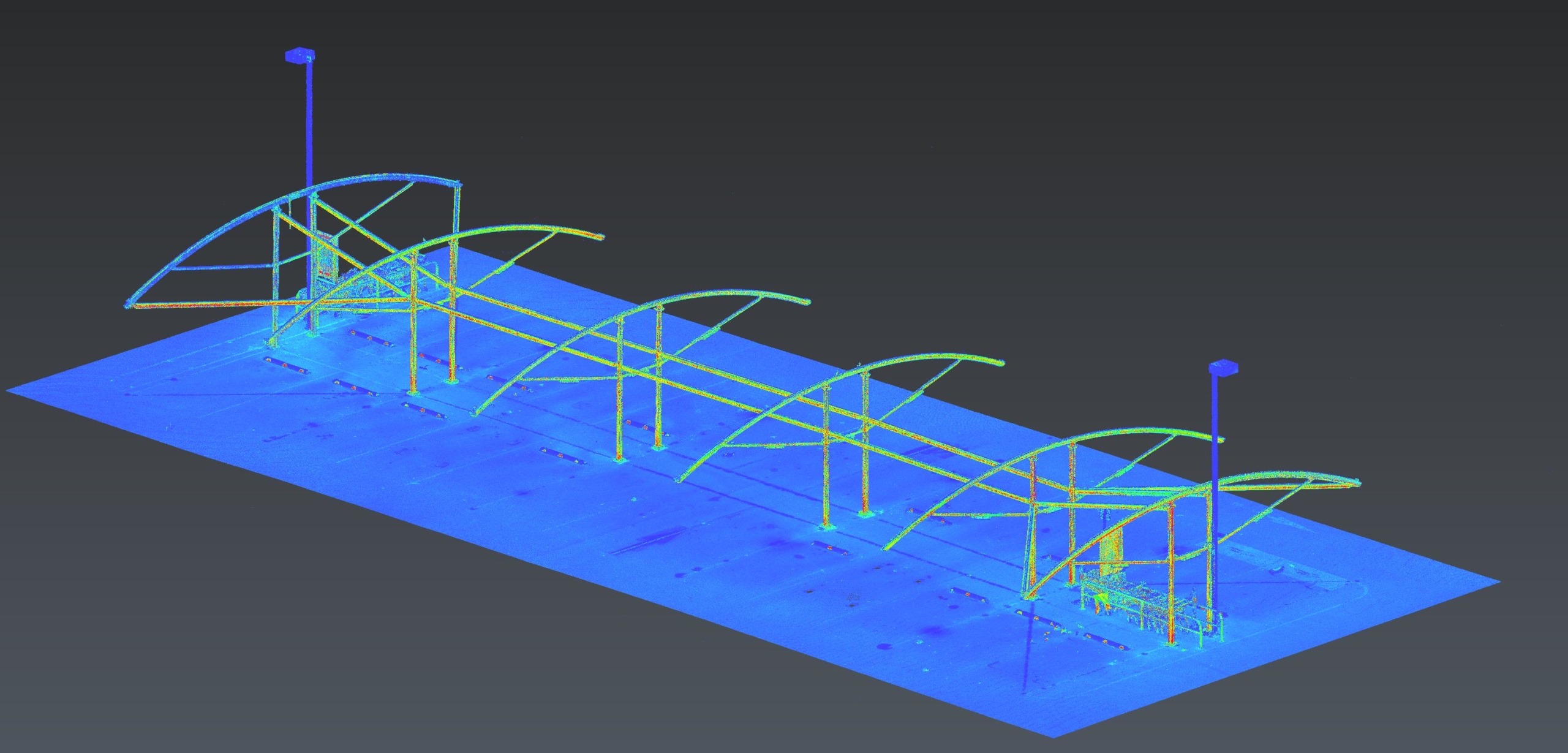
The laser scanner emits hundreds of thousands of pulses of light per second which reflect off the environment, enabling the technology to capture slender objects and provide high detail of complex assemblies.
As an active sensing technology, laser scanning is not reliant on ambient lighting conditions or contrasting surfaces, as is the case for Photogrammetry. This allows laser scanning to work at night and in poorly lit environments.
Coordination of control points and targets within the scene allow for geolocation of the resulting outputs and eliminates reliance on GPS signal (unlike drone LiDAR).
Laser scanning delivers the most accurate and highly detailed reality capture output. This makes it the ideal tool for precise reality capture of structures like bridges, tunnels and industrial process facilities.
THE MOST PRECISE REALITY CAPTURE TOOL FOR DIGITAL ENGINEERING

APPLICATIONS OF LASER SCANNING
- Survey of tunnels, culverts, bridges and inside buildings
- Survey of intricate structures that require high accuracy for architectural, fabrication and custom design purposes
- Reality capture of pipework and industrial process facilities
- Reality capture where GPS is unavailable
- Condition assessment of tanks and vessels using deformation analysis
- Scan-to-CAD and Scan-to-Revit where high precision and accuracy is required
DATA OUTPUT
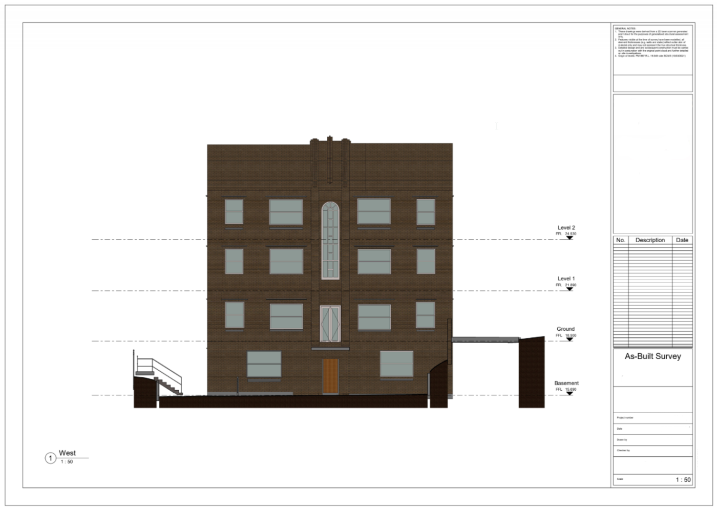
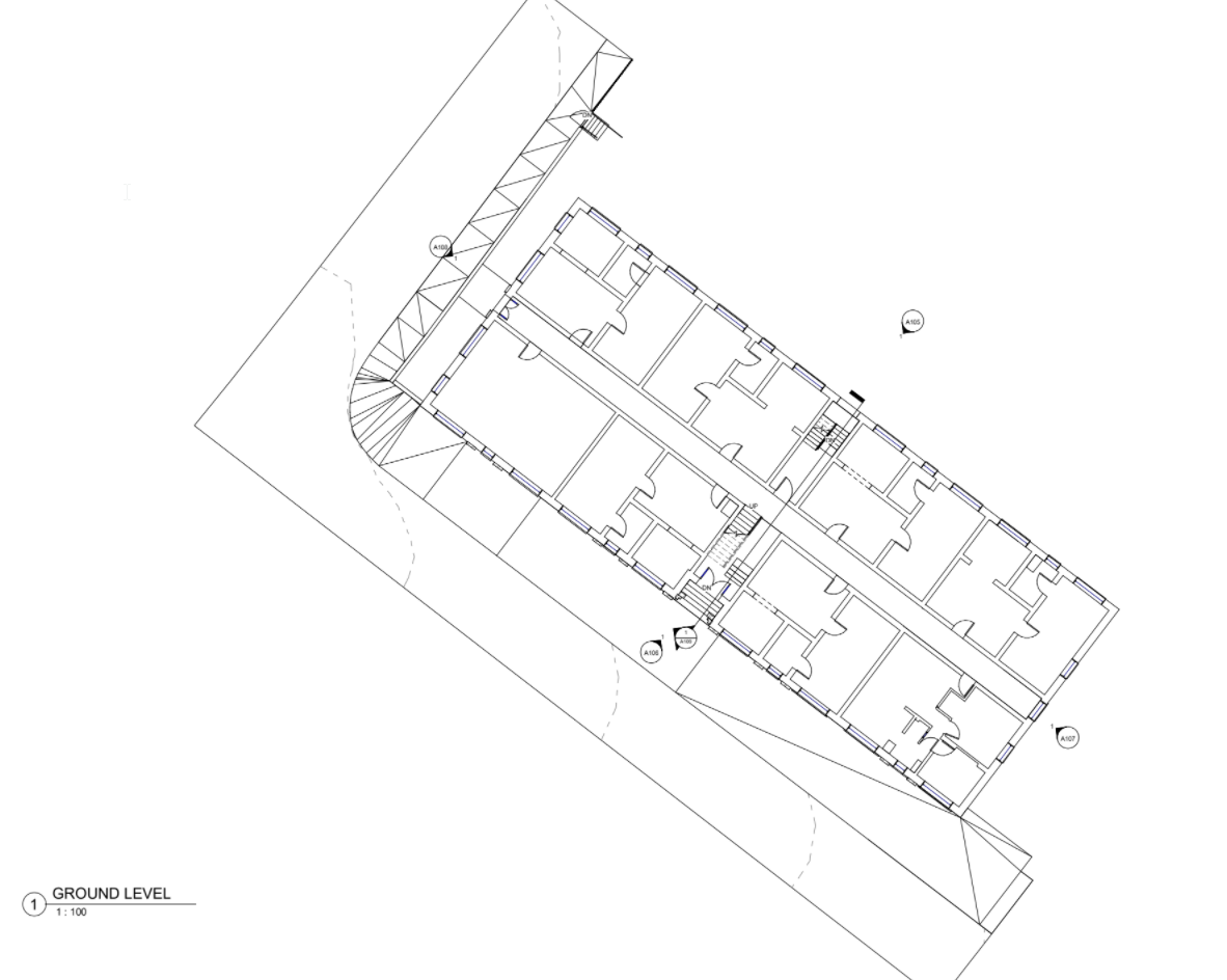
The primary data output from laser scanning is a 3D point cloud. Our data technicians and expert modellers then extract the key features from the point cloud to convert it in to linework or models as required.
The linework and 3D model can then be taken to full drafted sheets including any plan, elevation and/or cross-sections to suit the project requirements.
Diospatial can deliver the data to suit any number of third party geospatial and CAD/Revit applications as the basis of scan-to-CAD or scan-to-Revit workflows. Diospatial can deliver the files in the native file format for use in specialist third party software, and in a range of industry standard formats.
PAST PROJECTS
REVIT Modelling of Factory Pipes
High accuracy terrestrial laser scanning survey and scan-to-Revit modelling of ammonia piping…
Geospatial Survey of Road Corridor
Drone LiDAR, photogrammetry modelling, terrestrial laser scanning and detail survey of road…
3D Survey & Digital twin of Dam & Wat…
Geospatial Survey of Dam & Infrastructure using Drone LiDAR, photogrammetry, laser scanning…
Complete Spatial Solution for Geotechnical Asse…
LiDAR, photogrammetry and Laser Scanning of road corridor and landslip for geotechnical…