Land Management
Since 2016, Diospatial has worked closely with government and private sector land management bodies to provide survey and inspection solutions for a range of applications. Leveraging remote sensing technologies such as LiDAR, photogrammetry, and multispectral imaging, our solutions have assisted with the investigation and assessment of geotechnical risks, and monitoring and management of significant land areas throughout Australia.
This has enabled land operators and owners to:
- Improve access to hard to reach areas in a safe manner
- Capture the real world, enabling planners to replace assumptions with facts
- Efficiently capture large areas
SERVICES WE PROVIDE FOR THE LAND MANAGEMENT SECTOR
Our team has worked closely with National Parks, Local Government and private sector land management bodies on a range of projects and service areas, including:
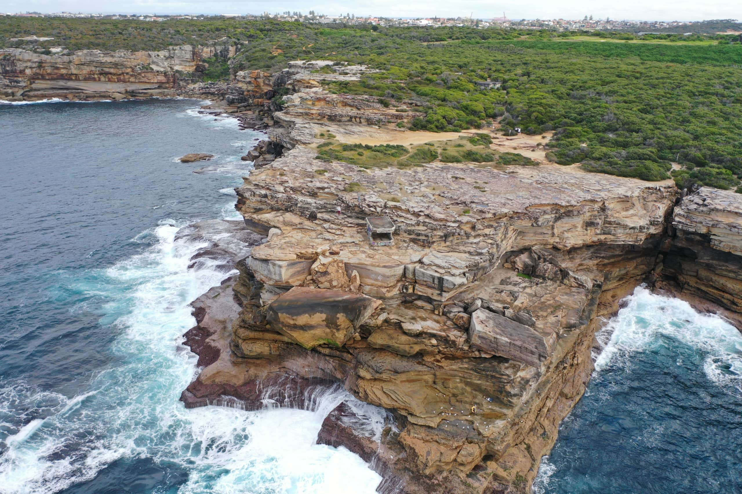
- Survey and inspection to identify geotechnical risks, particularly in hazardous and hard to reach sites like cliff lines and rockfall risks, for engineering investigation and assessment
- Coastal erosion, beach erosion and land erosion monitoring
- Post-fire and severe weather event aerial surveys
- Geo-hazard mapping including landslides, rockfall risks, boulder and overhang identification
- Topographic survey for Flood Modelling and Hydraulic Modelling
- 3D modelling and survey across the Grampians, Victoria
- 3D modelling and survey over more than 40km of the Sydney Metropolitan Coastline for geotechnical assessment
- Reality Capture and 3D modelling of walking track alignments and upgrades
- Identification and quantity survey of Asbestos Containing Materials
CLIENTS WHO TRUST US

PAST PROJECTS
Aerial Survey of Council Lookout for Geotechnic…
Drone-LiDAR survey and 3D photogrammetry modelling of slopes and surrounding area of…
Complete Spatial Solution for Geotechnical Asse…
LiDAR, photogrammetry and Laser Scanning of road corridor and landslip for geotechnical…
Geospatial Survey for Geotechnical Assessment
Drone LiDAR, photogrammetry modelling and geospatial analysis of rockfall and landslide to…
LiDAR for Topographic Surveys
Drone LiDAR Survey for terrain modelling and extracted topographic data for surveying…