Dilapidation Survey
Diospatial’s dilapidation survey solutions use a range of reality capture tools to provide the most accurate dilapidation survey solution. Combining laser scanning, conventional survey, imaging and photogrammetry, our team develops the most suitable methodology to provide a high accuracy survey of an asset or structure that is millimetre accurate. This enables the highest precision outputs for mapping, detecting and monitoring defects and dilapidation of buildings, assets and structures.
DILAPIDATION SURVEY SOLUTION FOR INFRASTRUCTURE AND ASSETS WHERE PRECISION AND ACCURACY ARE CRITICAL
Our team of engineers and surveyors work to understand the project context and then develop the most effective methodology – whether that is laser scanning, photogrammetry modelling or as a component of a more holistic reality capture solution.
Our expert data technicians then carefully map, measure and compile a complete dilapidation survey report that can relied up for assessment by engineers and asset owners and operators.


APPLICATIONS OF DILAPIDATION SURVEYS
Diospatial’s dilapidation surveys provide a high accuracy survey and reporting that can be used for, but not limited to:
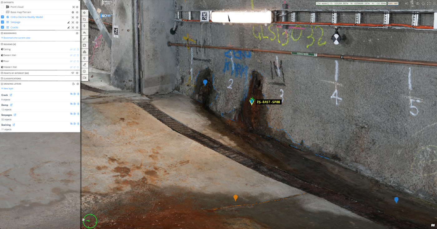
- Crack, defects and damp mapping of tunnels and pipes
- Dam and spillway defect mapping and monitoring
- Thermal anomalies in structures
- Construction monitoring
- Infrastructure defect mapping, structural integrity assessment and monitoring
- As-Built survey of buildings, factories and structures
- Change detection
- Digital documentation
DEliverables of dilapidation surveys
The outputs can be exploited in any number of geospatial file formats, and most commonly delivered in file types including:
- Plan and elevation view drawings (PDF)
- Photogrammetry model with feature extraction of defects, cracks and damp
- Orthophoto
- CAD and Revit modelling with feature extraction and linework
- Video and high resolution imagery
- Quality report
- Web based 3D model hosted on Pointerra, with all geospatial data available to all project stakeholders


QUALITY, EXPERIENCE AND TRUST IS WHAT SEPARATES DIOSPATIAL FROM EVERYONE ELSE
Our team is known for delivering the highest quality data and customer service in the industry. A relentless focus on quality control ensures we consistently meet or exceed project specifications. We understand client satisfaction requires client success, and our outcome-driven approach starts at scope development. We work with your team to ensure survey specifications and outputs are optimised to meet downstream user requirements and our support continues beyond delivery to ensure maximum utilisation of the data outputs.
Past Projects
Culvert Dilapidation Inspection
Visual inspection and reporting of culvert condition and structural integrity to support…
Tunnel Dilapidation Survey
defect mapping of tunnel for pre-construction dilapidation survey using photogrammetry modelling and…
Inspection, Survey and Defect Mapping of Dam us…
High resolution inspection and defect mapping over more than 60,000m2 of concrete…
Dam Defect Mapping
Drone-based inspection, digital defect mapping and precision aerial survey for one of…