Services
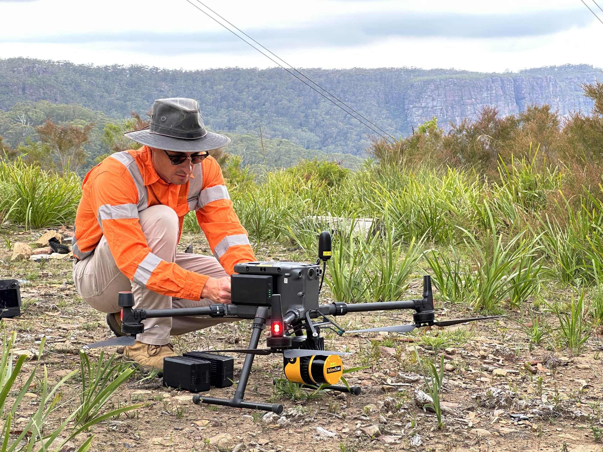
DRONE SURVEY
Utilising precision aerial sensing technology for the most accurate, detailed and precise capture of large and elevated environments. Diospatial’s drone survey solutions are the pinnacle of our reality capture services, consistently delivering industry leading quality and insight for digital engineering of Australia’s critical infrastructure.

Photogrammetry modelling
Providing rich visualisation of the real world into a high detail 3D digital model to support inspection, planning and design of remediation and construction work. Using a range of capture technologies, our expert reality capture team and data technicians produce a geolocated and spatially accurate photogrammetry model that is of the highest standard in the industry.
Bathymetric Survey
For spatial and modelling information underwater, Diospatial’s bathymetric survey solutions provide engineers with important terrain modelling data and accurate survey to support underwater assessment and design works. Our bathymetric surveys are a continuation of our topographic survey solutions when combined with drone LiDAR to deliver a complete terrain profile above and below water.

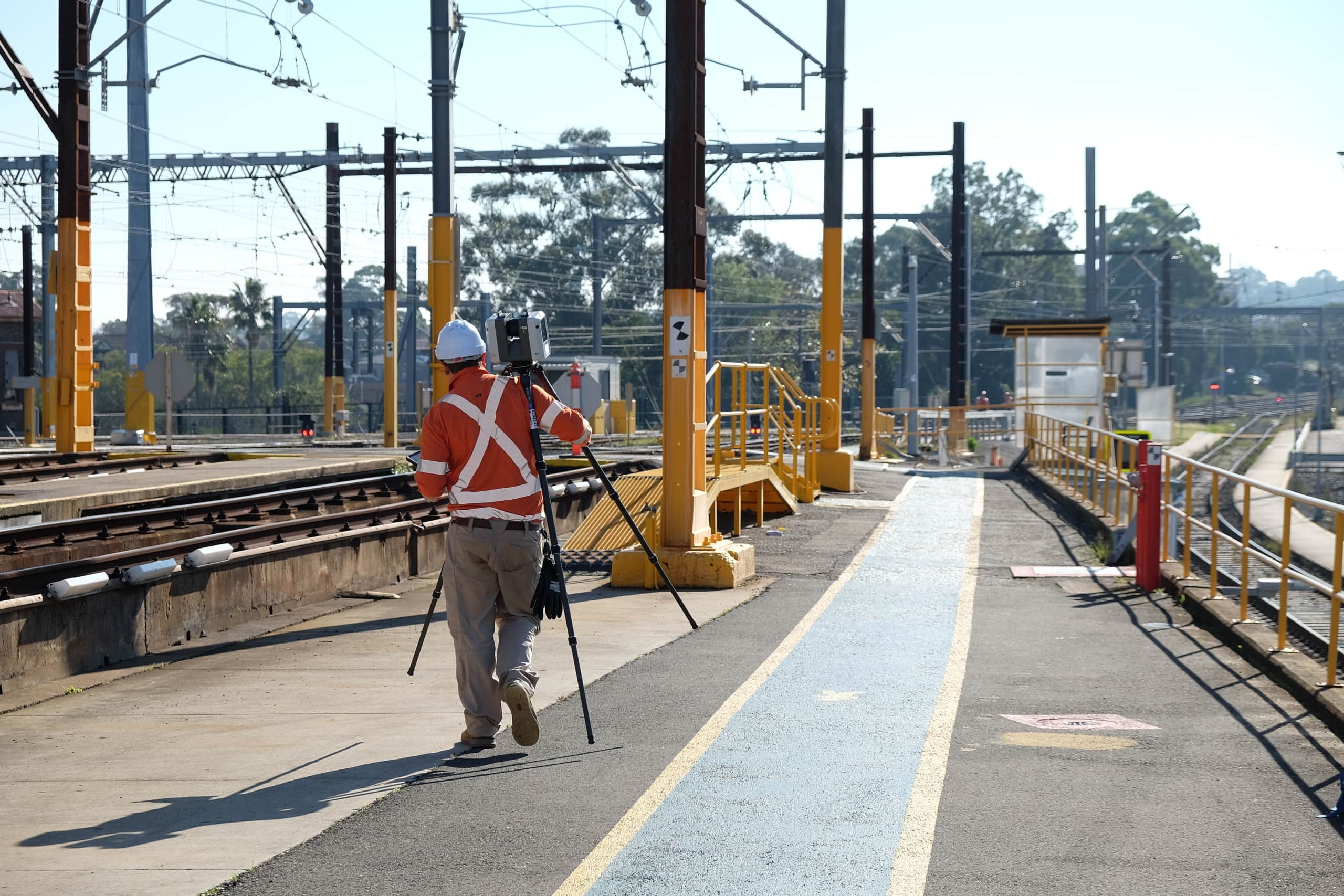
LASER SCANNING & Survey
Ground based survey and terrestrial laser scanning for the most precise and detailed capture of complex structures and indoor environments. Diospatial utilises the latest laser scanning technology and a robust network of ground control to deliver the highest quality survey and scanning solutions to the AEC sector. Our survey grade data deliverables are the foundation of digital engineering workflows that can be delivered in specialist file formats to support the ongoing design workflows.
BIM Modelling
An extension of our digital engineering services – our expert BIM modelling and rigorous quality control for industry leading scan-to-CAD and scan-to-Revit solutions. We understand the point cloud is often only the starting point and so we can develop a range of suitable outputs and formats from basic CAD modelling of weirs to LOD300 modelling of bridges. Our deliverables form the basis of engineering design works and the start of the construction process.


gEOTECHNICAL sURVEY
With over 9 years experience providing geotechnical survey support to Australia’s largest infrastructure and asset owners, Diospatial is Australia’s leading and most trusted provider of geotechnical survey. As experts utilising a range of reality capture tools, including drone LiDAR, photogrammetry and laser scanning, Diospatial ensures geotechnical engineers are given a robust data set that they can rely on.
dILAPIDATION SURVEY
Diospatial’s dilapidation survey solutions use a range of reality capture tools to provide the most accurate dilapidation survey solution. Combining laser scanning, conventional survey, imaging and photogrammetry, our team develops the most suitable methodology to provide a high accuracy survey of an asset or structure that is millimetre accurate.


inspection
Outcome-driven inspection solutions which combine visual inspection, thermal imaging, 3D modelling, and machine learning to deliver comprehensive asset inspection and defect mapping solutions. From close visual inspection of culverts, to drone inspection of bridges, our engineers deliver the facts and information needed to inform your condition assessment. Our solutions are tailored to meet the site constraints, conditions and data requirements, so a bespoke solution is designed to meet your specific project needs.
Change Detection & Monitoring
Designed to provide engineers with a reliable, remote and real-time spatial solution, Diospatial’s change detection and monitoring solutions utilise high precision reality capture and sensing technologies to allow engineers to better focus their time where and when measurable risks occur. This replaces assumptions with facts, improves the allocation of resources and improves the success of remediation works.
As-Built Survey
Diospatial’s as-built surveys deliver unparalleled accuracy and precision, making them the ideal foundation for construction and architecture projects. Whether you’re planning a refurbishment project or want to capture a completed build for archival purposes, our As-Built survey solutions provide a reliable and detailed mapping solution, reducing costly errors and rework down the line.