Geospatial Survey of Road Corridor
Drone LiDAR, photogrammetry modelling, terrestrial laser scanning and detail survey of road corridor and adjacent slopes for geotechnical assessment.
PROJECT OVERVIEW
After heavy rainfall, geotechnical assessment was required on a stretch of road and adjacent slopes. The consulting engineers required terrain data and high detail imagery to identify any geotechnical hazards, and detail survey in specific areas where it appeared a landslip had occurred.
The terrain was heavily vegetated and hard to access so conventional survey was not possible.
Project Scope
Drone LiDAR & Photogrammetry
TLS & Detail Survey
Digital Twin
DIOSPATIAL SOLUTION
Diospatial developed a complete geospatial solution that utilized aerial and terrestrial based capture techniques. This included drone LiDAR for terrain modelling, high detail photogrammetry for visual assessment, and terrestrial laser scanning and detail survey at specific sites where higher accuracy was required.
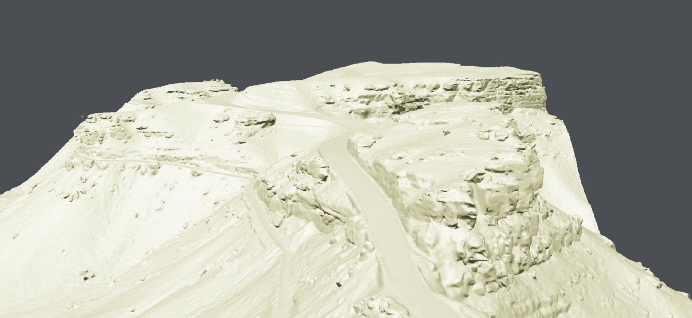
Drone LiDAR was used for its ability to penetrate vegetation and to efficiently cover a large area. The LiDAR survey was captured at a high point density and the point cloud was classified for ground and non-ground points. From this, the digital terrain model (DTM) could be produced, which was then used to derive elevation contours and surface drainage.
High resolution images were captured of the site and processed in photogrammetry software to produce a 3D digital twin. The scale-accurate digital twin provided rich visualisation of the site to support geological mapping of rock exposures.
Since the tree canopy and vegetation made visualisation hard in areas, Diospatial data technicians completed mesh editing on the model to remove vegetation. This enabled consulting engineers to complete a robust geotechnical assessment of slopes and support design of rock stabilization solutions.
Aerial LiDAR and photogrammetry was captured during a live road corridor, while terrestrial laser scanning and detail survey was captured during night works—all to reduce the impact to road users.
All drone works were completed during the day while the road corridor was open, reducing the impact to users.
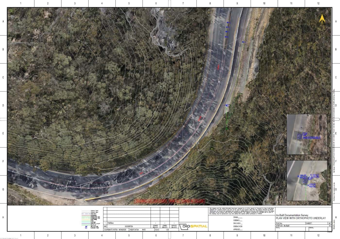
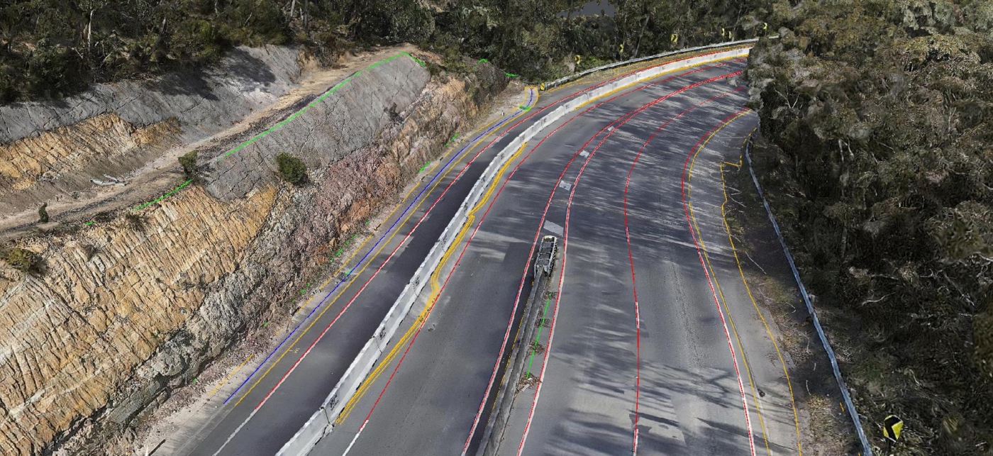
In areas were more precise measurements and extraction of road features like pits and culverts was required, Diospatial used terrestrial laser scanning and detail survey to capture the geospatial data. These works were completed at night time during road closures to minimise disruption to road users.
The complete geospatial data set was delivered in specialist software formats, as well as hosted on a web-based 3D GIS platform, Pointerra. This allowed project stakeholders to visualize, interrogate and download data without the need for specialist software or powerful computing hardware.