survey
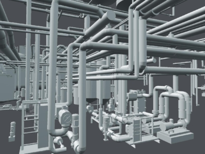
REVIT Modelling of Factory Pipes
High accuracy terrestrial laser scanning survey and scan-to-Revit modelling of ammonia piping…

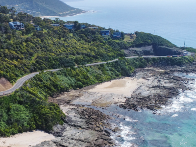
Geotechnical Monitoring solution For High Risk slopes
monitoring of road corridor and associated high risk slopes to support on-going…
Tunnel Dilapidation Survey
defect mapping of tunnel for pre-construction dilapidation survey using photogrammetry modelling and…
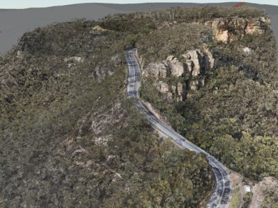
Geospatial Survey of Road Corridor
Drone LiDAR, photogrammetry modelling, terrestrial laser scanning and detail survey of road…

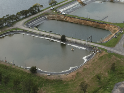
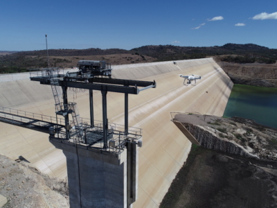
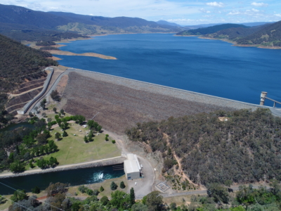
3D Survey & Digital twin of Dam & Water Infrastructure
Geospatial Survey of Dam & Infrastructure using Drone LiDAR, photogrammetry, laser scanning…
Water Treatment Plant Reservoir Survey and Modelling
Drone-Lidar and Photogrammetry survey of water treatment plant reservoir for condition assessment…
LiDAR for Topographic Surveys
Drone LiDAR Survey for terrain modelling and extracted topographic data for surveying…
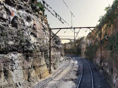
As-Built Survey of Rail Corridor for Engineering Design
High resolution drone LiDAR, photogrammetry and as-built survey of rail corridor for…
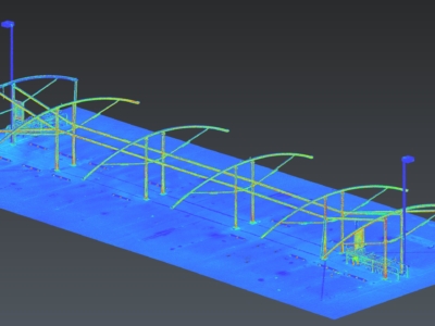
Scan-to-CAD for Fabrication Design
Terrestrial laser scanning As-Built survey of existing shade structure for detailed design…
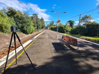
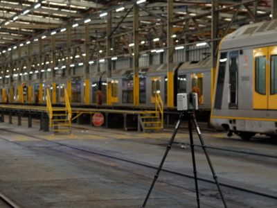
As-Built Survey of Train Station
Terrestrial laser scanning survey to produce as-built survey of train station for…
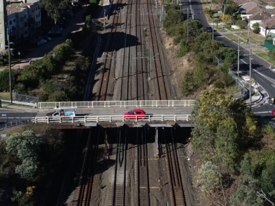
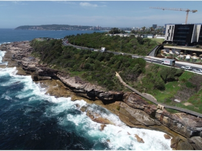
Laser Scanning of Bridge Road for Design
Laser Scanning survey and photogrammetry reality model of bridge and surrounding areas…
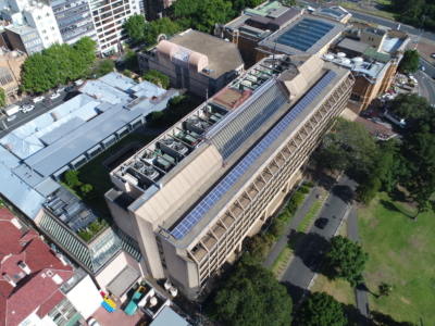
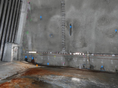
Laser Scanning and Inspection of Rooftop Plant Room
Laser Scanning and drone inspection for condition assessment and Survey of NSW…

Meet the D-Team Series: Joe Culliver
In our Meet the D-Team Series, we want you to get to…
LiDAR Survey of Roadside Cuts and Slopes for Stabilisation Designs
Drone-LiDAR derived topographic survey and photogrammetry modelling for slope stabilisation designs PROJECT…
OHL Inspection and Monitoring using Laser Scanning
Laser Scanning and drone-inspection for OHL conformance and clearance monitoring PROJECT OVERVIEW…
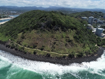
Reality Capture using Photogrammetry for Slope Stabilisation works
Reality capture and Digital survey for slope stabilisation Works As Executed drawings…
Inspection, Survey and Defect Mapping of Dam using Photogrammetry, Thermal IR and Imaging
High resolution inspection and defect mapping over more than 60,000m2 of concrete…
Photogrammetry derived Reality Capture for Boardwalk Design and Geotechnical Assessment
High resolution drone LiDAR survey and Photogrammetry modelling for design of elevated…
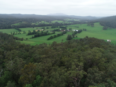
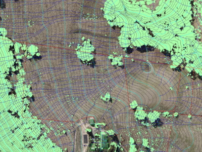
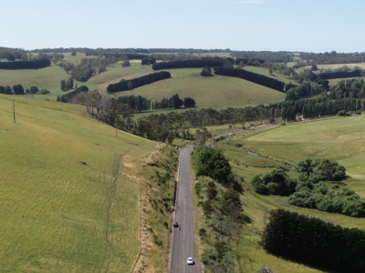
Drone LiDAR survey for DA Survey of Rural Land
Drone based contour survey and boundary stakeout of 30ha rural property for…
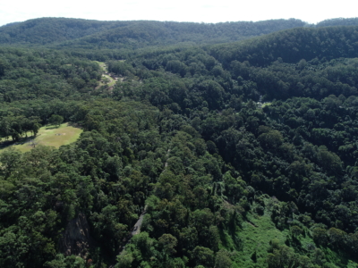
LiDAR Survey and Reality Model for Geotechnical Assessment of hillside
High resolution drone LiDAR survey and 3D reality modelling to inform geotechnical…
DA Survey of Semi-Rural Property using LiDAR
Drone based contour survey of semi-rural property for subdivision planning and DA…
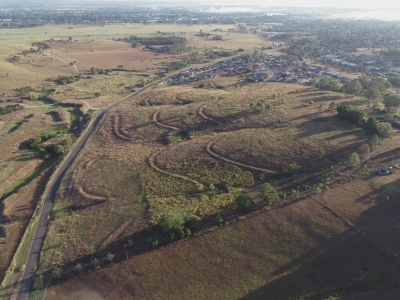
Geo-Hazard Mapping and Slope Risk Assessment
High resolution Drone-LiDAR survey for slope risk assessment of remote and densely…
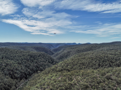
LiDAR Survey for Geotechnical Assessment
High resolution Drone LiDAR survey of Illawarra Escarpment for geotechnical assessment and…
Dam Defect Mapping
Drone-based inspection, digital defect mapping and precision aerial survey for one of…
Rail Corridor Drainage Mapping
Drone LiDAR survey through dense vegetation to identify and Complete surface drainage…
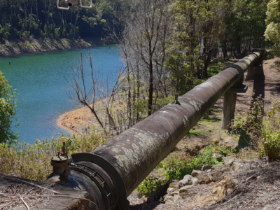
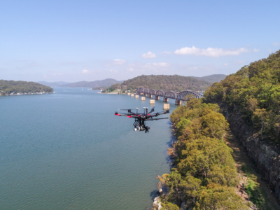
Inspection of water supply pipeline
High detail Reality Capture over 5km of water supply pipeline using drone…