Reality Capture
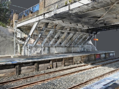
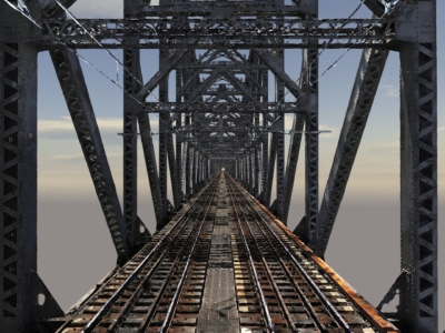
3D Modelling of Rail Bridge
terrestrial laser scanning and Photogrammetry 3D modelling of RAIL bridge for engineering…
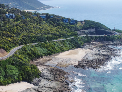
Digital Twin of Road Corridor
Aerial LiDAR and photogrammetry survey of ~51km road corridor and adjacent slopes…
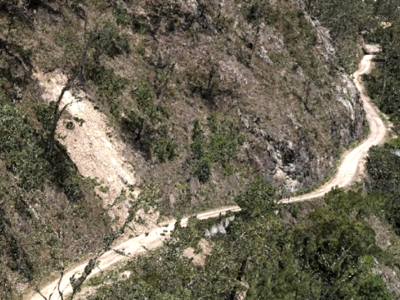
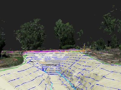
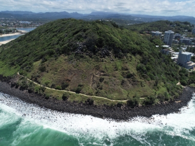
Aerial Survey of Council Lookout for Geotechnical Assessment
Drone-LiDAR survey and 3D photogrammetry modelling of slopes and surrounding area of…
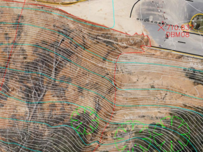
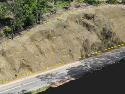
Complete Spatial Solution for Geotechnical Assessment
LiDAR, photogrammetry and Laser Scanning of road corridor and landslip for geotechnical…
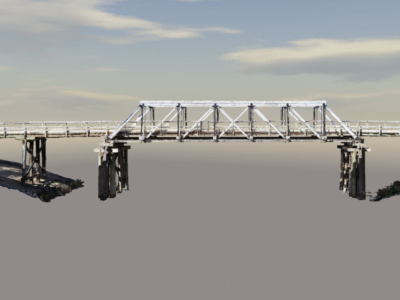
High Detail Digital Twin of Rail Bridge
High Detail Digital Twin of rail bridge to assist with the planning…
Photogrammetry Modelling of a Bridge
High detail photogrammetry modelling of a bridge for heritage archives. PROJECT OVERVIEW…
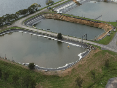
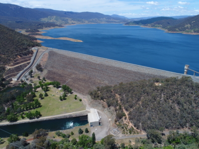
Water Treatment Plant Reservoir Survey and Modelling
Drone-Lidar and Photogrammetry survey of water treatment plant reservoir for condition assessment…
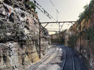
As-Built Survey of Rail Corridor for Engineering Design
High resolution drone LiDAR, photogrammetry and as-built survey of rail corridor for…
Completing the project lifecycle with As-Built surveys
Returning to sites in Victoria for as-built surveys of completed slope stabilisation…
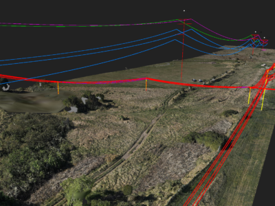
Geospatial Survey to Support Transmission Line Design
Topographic and detail survey over proposed electricity transmission alignment for engineering design….
Multiple Landslide surveys
Combining drone lidar, photogrammetry and terrestrial laser scanning of multiple landslip sites…
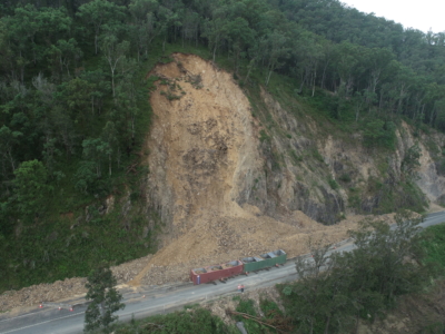
Geospatial Survey of Roadway Landslide
Using Drone Lidar and photogrammetry to inform geotechnical Risk assessment and design…
Complete Spatial Survey Solution
Geospatial survey solution combining drone lidar, photogrammetry, laser scanning and multi-beam sonar…
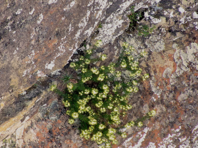
Environmental Spatial Solution to Survey Rare Plant Species
Aerial survey of the leionema lachnaeoides rare plant species in the blue…
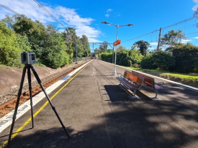
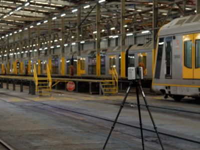
As-Built Survey of Train Station
Terrestrial laser scanning survey to produce as-built survey of train station for…
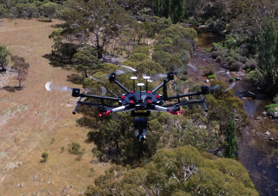
Drone-LiDAR and Photogrammetry Modelling for Engineering Design
Drone-LiDAR Topographic Survey and High Detail Photogrammetry modelling of Thredbo Valley Track…
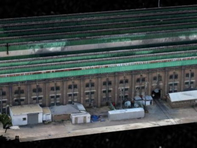
3D Reality Model of Building for Remote Inspection
High resolution drone-based imaging and photogrammetry derived 3D reality model of warehouse…
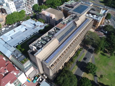
Laser Scanning and Inspection of Rooftop Plant Room
Laser Scanning and drone inspection for condition assessment and Survey of NSW…
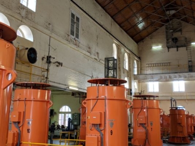
Pumping Station Reality Capture using Laser Scanning
Confined space Terrestrial Laser Scanning of sub-terranean pump wells for engineering design…
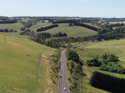
LiDAR Survey of Roadside Cuts and Slopes for Stabilisation Designs
Drone-LiDAR derived topographic survey and photogrammetry modelling for slope stabilisation designs PROJECT…
OHL Inspection and Monitoring using Laser Scanning
Laser Scanning and drone-inspection for OHL conformance and clearance monitoring PROJECT OVERVIEW…
Reality Capture for Motorway Bridge Inspections
Close visual inspection and 3D reality model of 40no. spans of Dual…
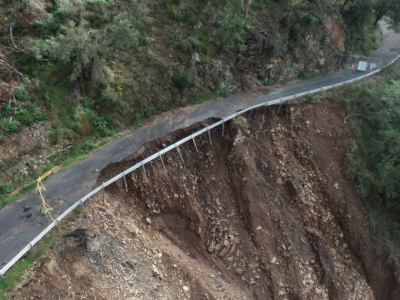
Reality Capture using Photogrammetry for Slope Stabilisation works
Reality capture and Digital survey for slope stabilisation Works As Executed drawings…
Inspection, Survey and Defect Mapping of Dam using Photogrammetry, Thermal IR and Imaging
High resolution inspection and defect mapping over more than 60,000m2 of concrete…
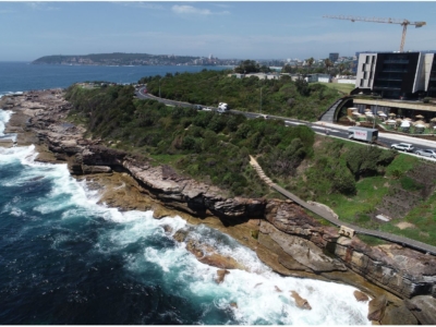
Photogrammetry derived Reality Capture for Boardwalk Design and Geotechnical Assessment
High resolution drone LiDAR survey and Photogrammetry modelling for design of elevated…
LiDAR Survey and Reality Model for Geotechnical Assessment of hillside
High resolution drone LiDAR survey and 3D reality modelling to inform geotechnical…
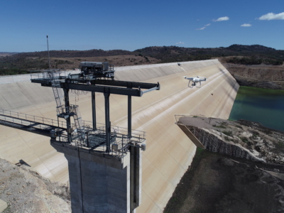
Dam Defect Mapping
Drone-based inspection, digital defect mapping and precision aerial survey for one of…
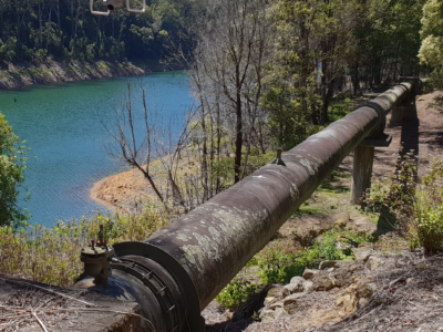
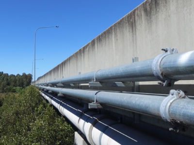
Inspection of water supply pipeline
High detail Reality Capture over 5km of water supply pipeline using drone…