Change Detection of Dam Spillway
Drone LiDAR and photogrammetry survey of dam spillway after rain events to complete a change detection assessment.
PROJECT OVERVIEW
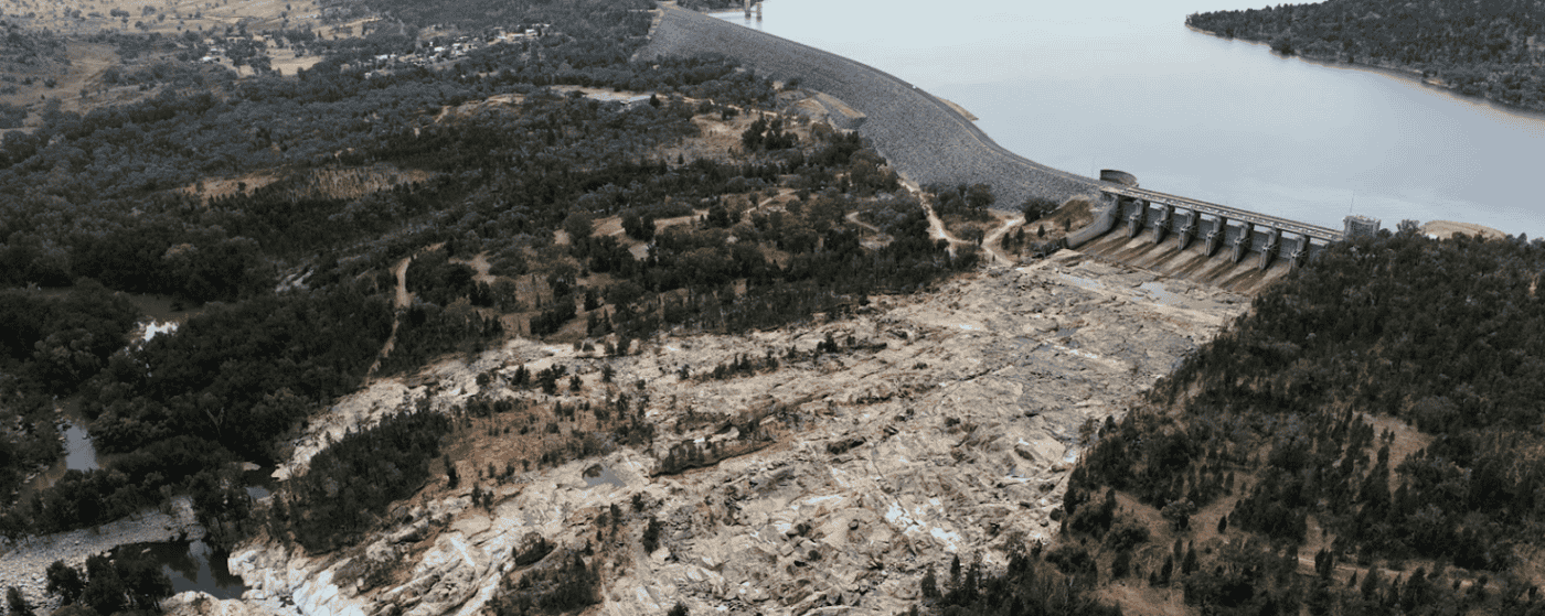
After recent rain events had triggered the release of water from a dam, an assessment of the condition of the dam spillway was required to understand what damage, if any, was done. Consulting engineers needed to assess the spillway for any erosion, scouring or significant changes that may have occurred.
Diospatial had completed a previous survey of the dam and spillway making it possible to complete a comparison by recapturing the site and comparing for changes
Project Scope
Drone LiDAR & Photogrammetry
Change Detection
Digital Twin
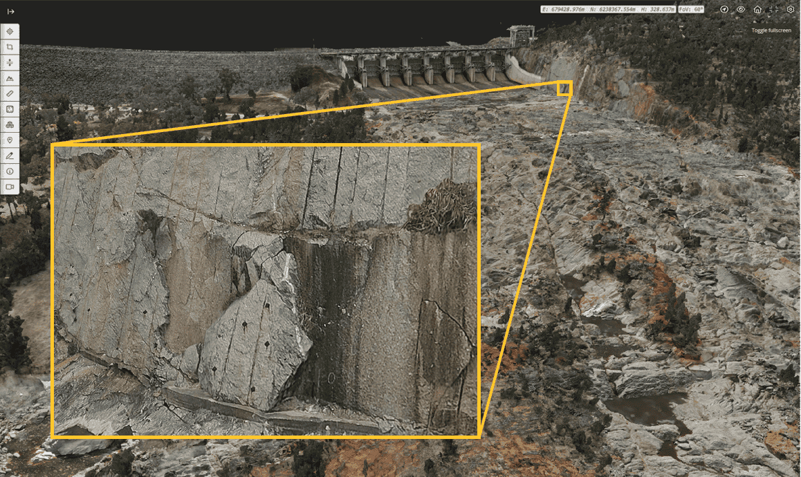
DIOSPATIAL SOLUTION
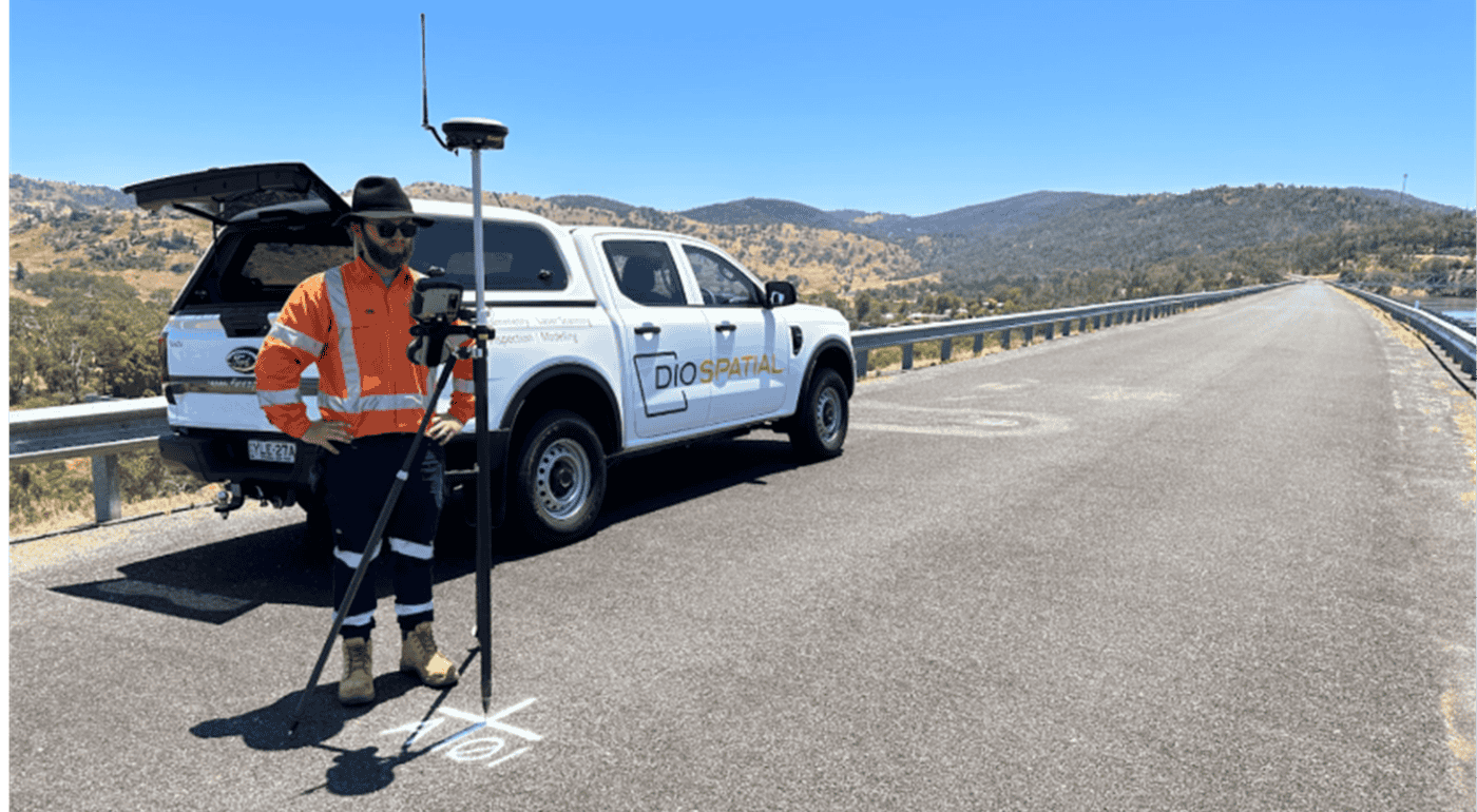
Diospatial developed a drone-based reality capture solution that utilised drone LiDAR and photogrammetry to capture the spatial and visual data of the dam, spillway and surrounding areas.
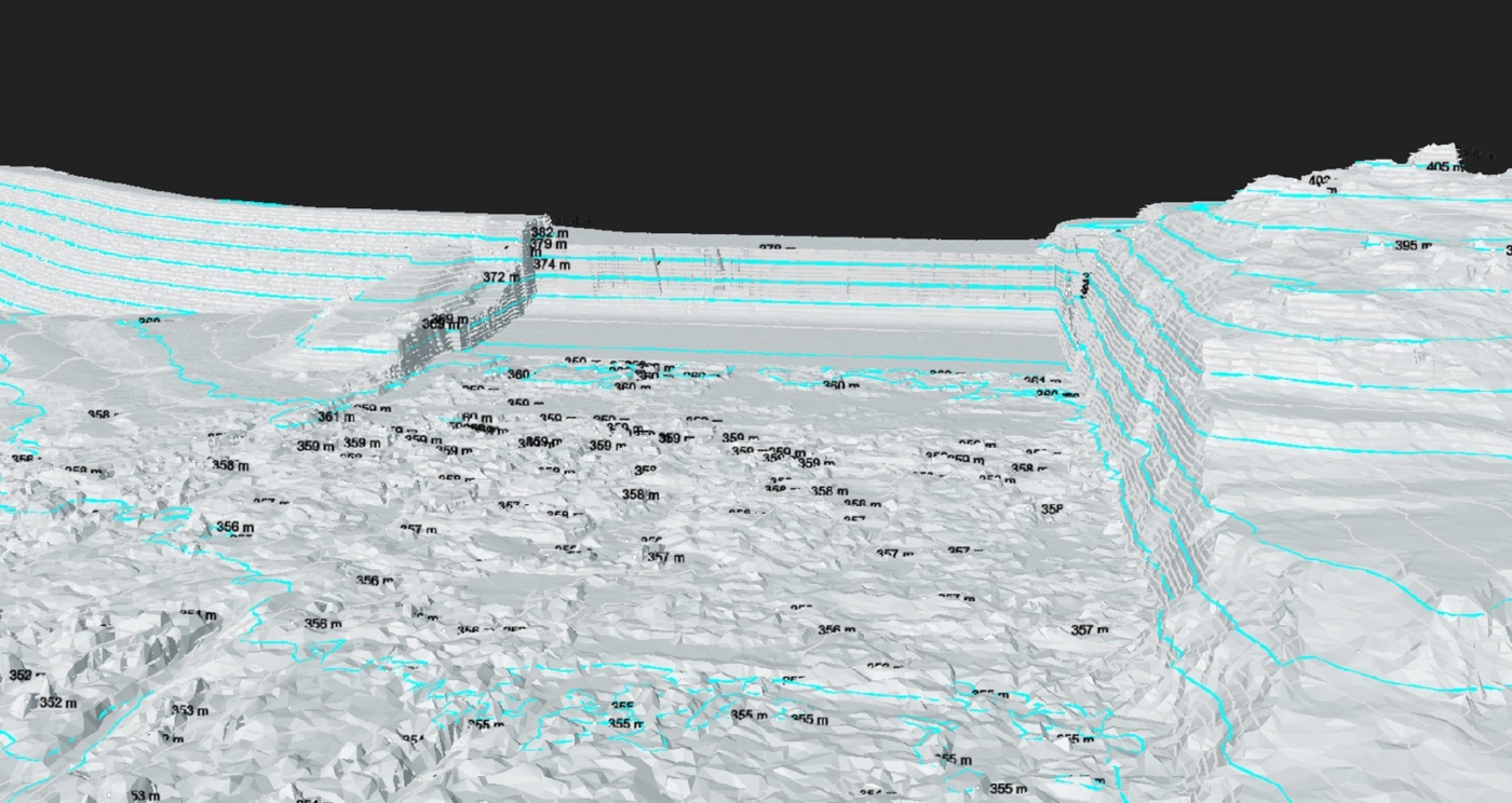
Drone LiDAR was used to capture the digital terrain model. The LiDAR was captured at a very high point density to allow for high resolution and accurate terrain modelling, even in areas of vegetation cover. The LiDAR point cloud was classified for ground, non-ground and overhanging terrain, and the surface mesh model and elevation contours was produced.
High resolution imagery was captured by the drone and processed in photogrammetry software to create a high resolution 3D textured mesh and orthophoto of the site.
The digital terrain models (DTM) from two surveys were compared to detect changes that may have been caused by recent spillway activity.
A robust network of ground control points were established throughout the site to ensure all spatial data was geo-located and spatially accurate. All data was coordinated to the same datum that was used for the previous survey to ensure an accurate comparison could be completed.
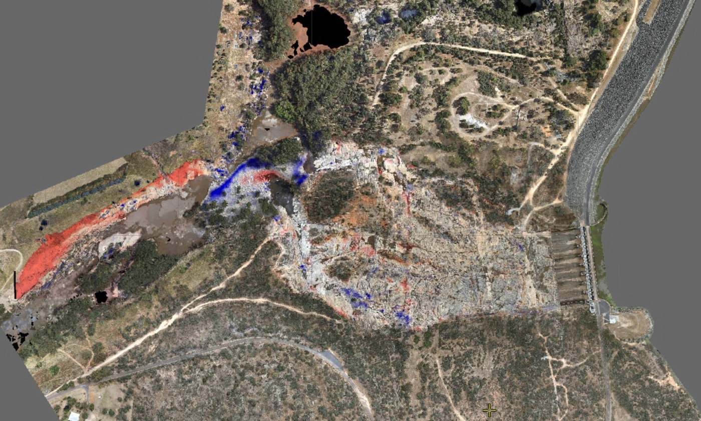
Rudimentary, raster based, change detection was completed by comparing terrain data from multiple epochs. The DTM from the most recent survey was compared to the DTM from the previous survey in April 2020, which was supplemented with State available data to cover areas outside the April 2020 capture area.
This change detection analysis indicated areas which may have been affected by recent spillway activity in the form of a heatmap.
All spatial deliverables from both the original survey completed in April 2020 and the most recent survey were compiled in to a 3D web-based GIS platform, Pointerra. This allowed project stakeholders to easily view and compare the survey data over time, interrogate, take measurements and collaborate across stakeholders, without the need for specialist software or powerful computing hardware.