Photogrammetry
What is Photogrammetry?
Photogrammetry is a passive sensing technology which converts 2D digital photographs into detailed and spatially accurate 3D point clouds, image mosaics and 3D reality models.
High resolution images are captured at a very high rate of overlap, and in conjunction with ground control survey and georeferencing metadata, are processed in photogrammetry software. The software automatically detects common points across multiple images, and then aero triangulates the set of photographs to create a geospatially accurate 3D representation of the environment. Further reconstruction of the 3D scene can then create dense point clouds, 3D textured meshes, Reality Models and a range of other outputs to serve as the basis of a Digital Twin.
The resolution, level of detail, precision, and accuracy can be varied to suit project specific requirements.
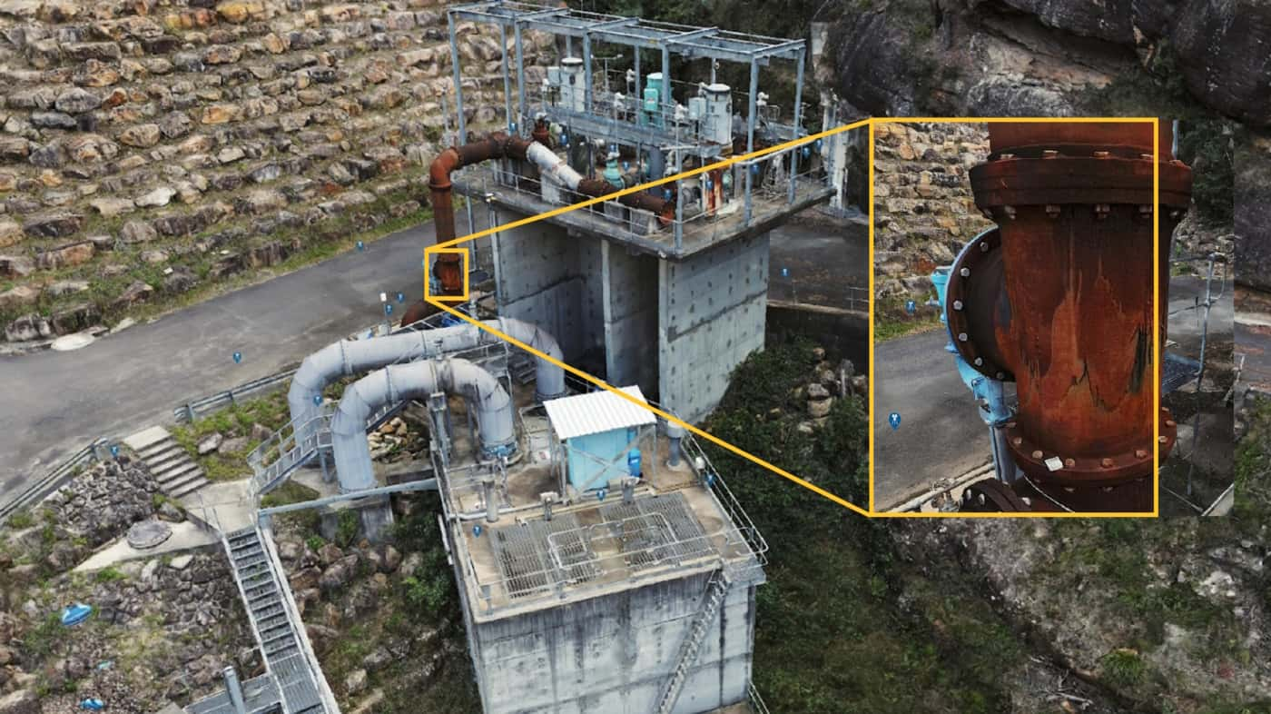
The photo-realistic nature of the outputs makes interpretation easy and intuitive, and an ideal basis for digital inspection of infrastructure and large assets.
Photogrammetry works exceptionally well in non-vegetated and high contrast environments, such as quarries, masonry structures and cliff faces, where precision and accuracy can exceed that of LiDAR.
A COST EFFECTIVE TOOL FOR PRODUCING A PHOTOREALISTIC MODEL SUITABLE FOR A RANGE OF SURVEY AND INSPECTION APPLICATIONS

APPLICATIONS OF PHOTOGRAMMETRY
- Digital inspection
- Defect mapping
- Survey of non-vegetated environments
- Reality modelling
- Digital archiving of heritage structures
- Engineering design and planning
- Construction progress monitoring
- Change detection
DATA Deliverables
- Point Cloud
- Reality Model
- Digital Surface Model (DSM)
- Digital Elevation Model (DEM)
- Orthophoto
- 3D image locations (ideal for digital inspection)
Our outputs can be easily integrated into your current workflow. We ensure that the data is provided in a suitable format for use in any number of third party applications.

PAST PROJECTS
3D Visualisation of Rail Tunnels
Hd imaging and 3d visualisation of rail tunnels to support inspection, design…
High Detail Digital Twin of Rail Bridge
High Detail Digital Twin of rail bridge to assist with the planning…
Photogrammetry Modelling of a Bridge
High detail photogrammetry modelling of a bridge for heritage archives. PROJECT OVERVIEW…
As-Built Survey of Rail Corridor for Engineerin…
High resolution drone LiDAR, photogrammetry and as-built survey of rail corridor for…
