Laser Scanning
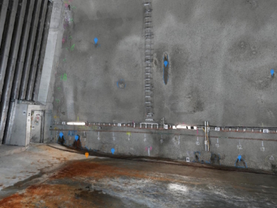
Tunnel Dilapidation Survey
defect mapping of tunnel for pre-construction dilapidation survey using photogrammetry modelling and…

3D Modelling of Rail Bridge
Photogrammetry modelling and terrestrial laser scanning of RAIL bridge for engineering design…
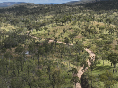
Spatial Survey for Windfarm Project
Drone LiDAR, orthophoto, terrestrial laser scanning and survey of project area and…
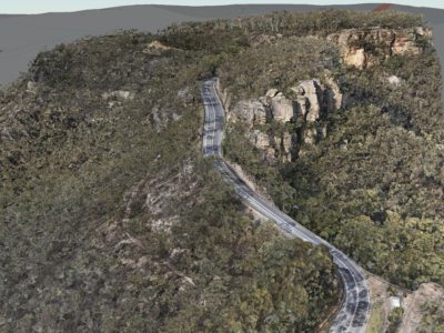
Geospatial Survey of Road Corridor
Drone LiDAR, photogrammetry modelling, terrestrial laser scanning and detail survey of road…

3D Survey & Digital twin of Dam & Water Infrastructure
Drone LiDAR, photogrammetry and high definition terrestrial laser scanning of water infrastructure…
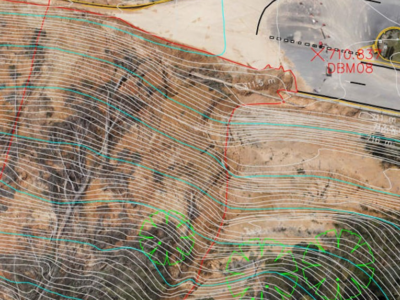
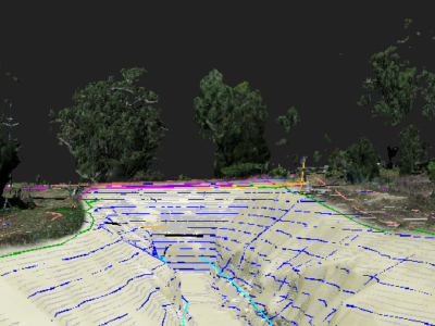
Complete Spatial Solution for Geotechnical Assessment
LiDAR, photogrammetry and Laser Scanning of road corridor and landslip for geotechnical…
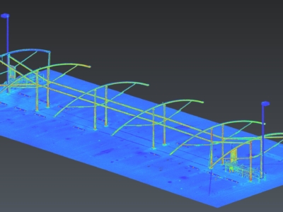
Scan-to-CAD for Fabrication Design
Terrestrial laser scanning As-Built survey of existing shade structure for detailed design…
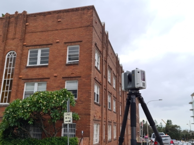
Survey of Residential Building
As-Built SURVEY AND Scan-to-Revit workflow OF RESIDENTIAL APARTMENT FOR DESIGN of remediation…
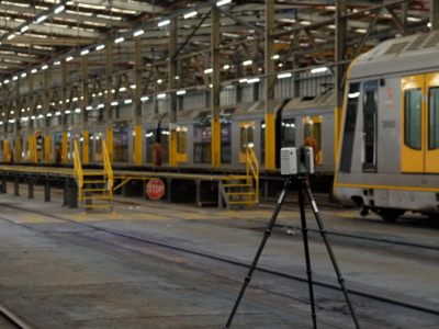
Sydney Central Yard Laser Scanning
Virtual feature and measurement extraction to assist with OHL tension analysis, reporting and…
Complete Spatial Survey Solution
Geospatial survey solution combining drone lidar, photogrammetry, laser scanning and multi-beam sonar…
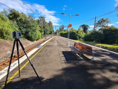
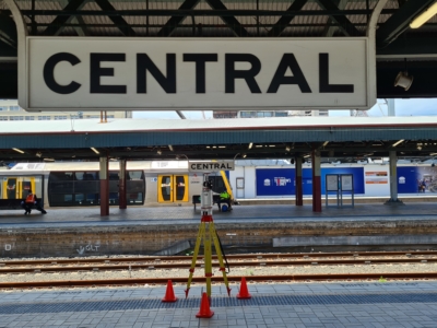
As-Built Survey of Train Station
Terrestrial laser scanning survey of train station to produce as-built survey for…
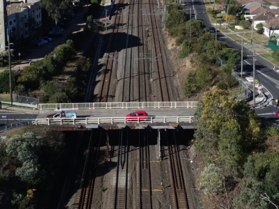
Laser Scanning of Bridge Road for Design
Laser Scanning survey and photogrammetry reality model of bridge and surrounding areas…
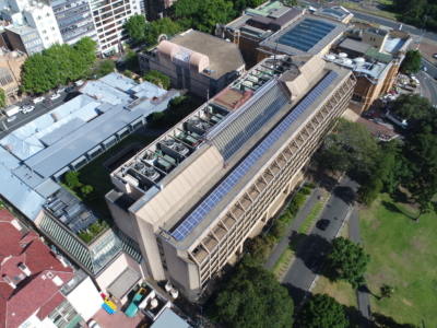
Laser Scanning and Inspection of Rooftop Plant Room
Laser Scanning and drone inspection for condition assessment and Survey of NSW…
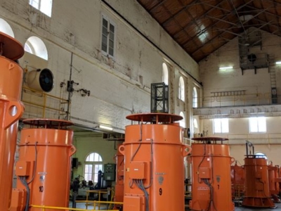
Pumping Station Reality Capture using Laser Scanning
Confined space Terrestrial Laser Scanning of sub-terranean pump wells for engineering design…
OHL Inspection and Monitoring using Laser Scanning
Laser Scanning and drone-inspection for OHL conformance and clearance monitoring PROJECT OVERVIEW…