Completing the project lifecycle with As-Built surveys
Returning to sites in Victoria for as-built surveys of completed slope stabilisation works.
PROJECT OVERVIEW
Diospatial was previously engaged to provide site investigation surveys across a number of geotechnical risk sites throughout regional Victoria. These survey outputs were used to assist with the planning and design of remediation works.
At the completion of the remediation works, the construction contractors and infrastructure managers required As-Built surveys to record the successful completion of works.
DIOSPATIAL SOLUTION
The Diospatial team was engaged to return to many of the geotechnical sites to complete As-Built surveys of the completed slope stabilisation works.
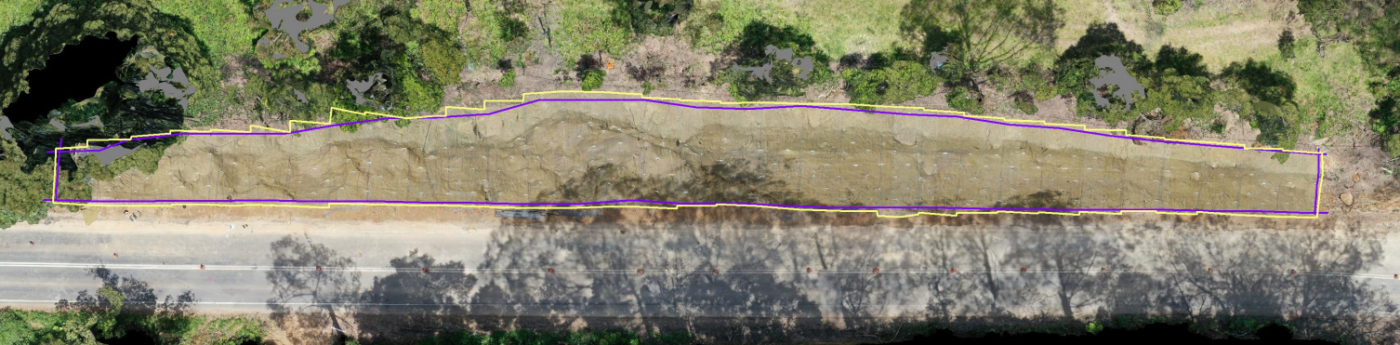
Diospatial developed a drone survey solution to capture in detail the project area and surrounding features. Extensive high resolution imagery was captured of the area and then processed in photogrammetry software to produce a 3D reality model.
The use of drones for Work As Executed survey enables rapid capture, safely and often without the need for traffic control.
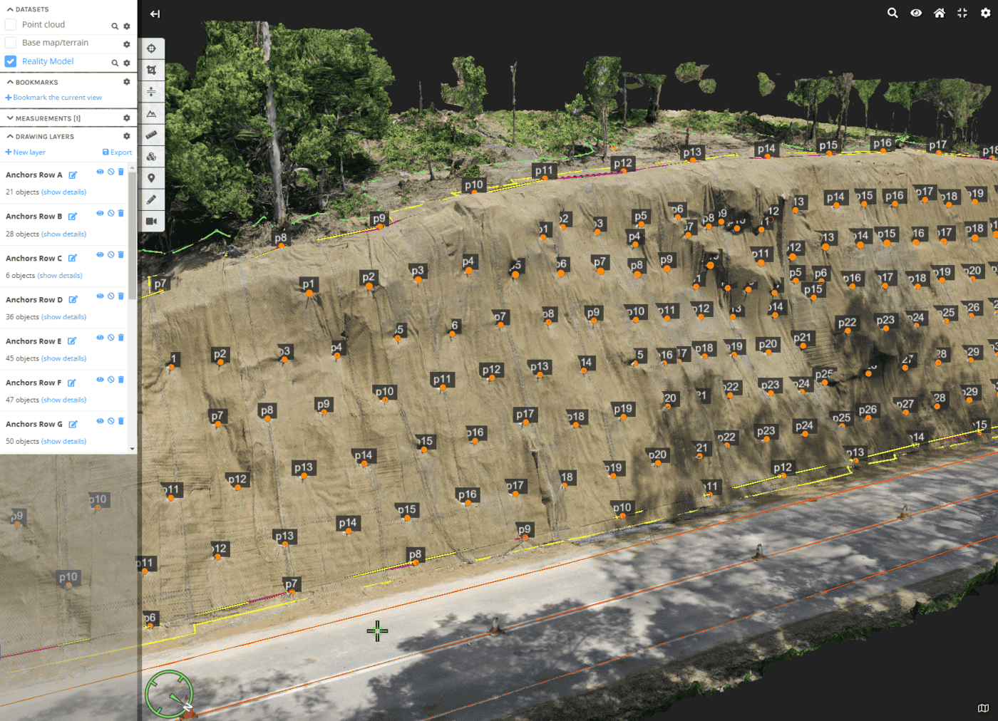
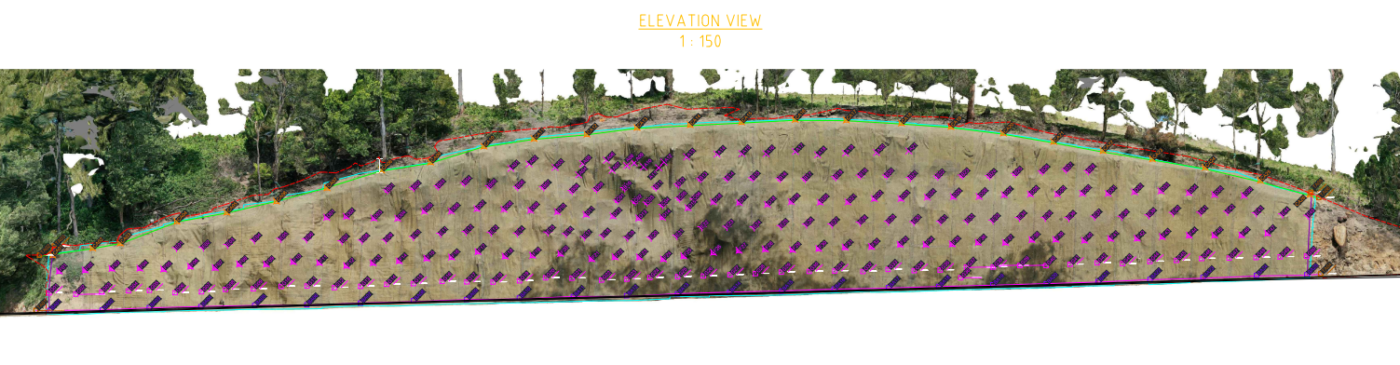
From the 3D spatial data, the Diospatial data technicians then extracted the Work-As-Executed features for survey drafting. These were supplied in 2D drawings and layered into the 3D reality model. The 3D reality model was hosted on a 3D web GIS platform for ease of visualisation and access across stakeholders.
The use of drone technology allowed the WAE surveys to be completed quickly, safely and often without the need for traffic control. A rapid and cost-effective means of capturing As-Built details for otherwise difficult to access, and costly to survey, sites.
Project Scope
Drone Survey
3D reality model
WAE Drawings