As-Built Survey of Train Station
Terrestrial laser scanning survey of train station to produce as-built survey for engineering design and construction planning.
PROJECT OVERVIEW
Diospatial was engaged by an engineering firm to complete an as-built survey of train station and the surrounding streets. The survey was required to aid in engineering design and construction planning of upcoming works.
DIOSPATIAL SOLUTION
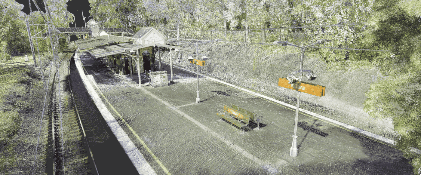
Diospatial developed a survey solution which utilised terrestrial laser scanning to develop a high accuracy point cloud of the sites and the surroundings. Due to the proximity to restricted airspace and populous areas, laser scanning was the ideal capture methodology.
Rigorous ground control achieved an accuracy of <5mm, with survey works completed over 2 days, while trains were running.
The terrestrial laser scanning capture included high resolution panorama photography which provided a detailed colourised point cloud, and was used to create a panorama photo viewer that enabled the client to virtually walk through the site, take measurements and make annotations.
Manual point cloud cleaning was completed to remove any “noise” from the data capture and provide the client with a clean and colour accurate point cloud.
The works were completed over 2 days on site, while trains were running and with no road or rail closures. When assessed against an extensive network of control points, Diospatial’s deliverables exceeded the project specifications of +/-10mm, achieving an accuracy of +/-5mm
PROJECT SCOPE
Terrestrial Laser Scanning
As-Built Survey
Panorama Photo Viewer
-
The Terrestrial laser scanning capture included high resolution spherical panorama photography which provided a detailed colourised point cloud and a powerful panorama photo viewer that functions similar to Google Street View (pictured right).
-
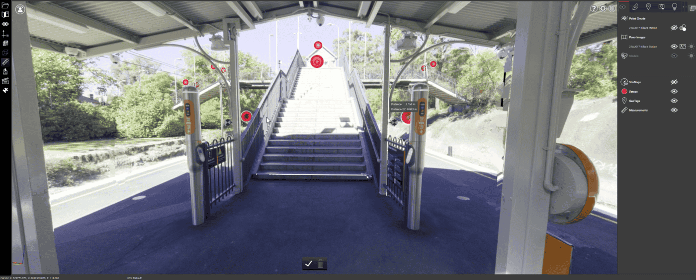
The panorama photo viewer is accessible to all stakeholders and enables them to virtually walk through the site, take accurate measurements, annotate and complete a digital inspection.