point cloud
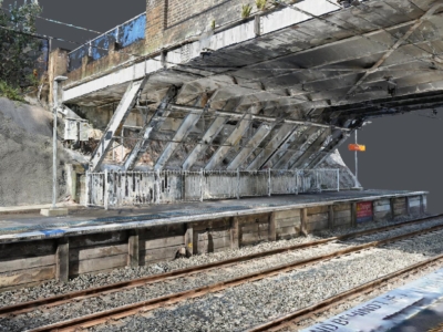
3D Modelling of Rail Bridge
terrestrial laser scanning and Photogrammetry 3D modelling of RAIL bridge for engineering…
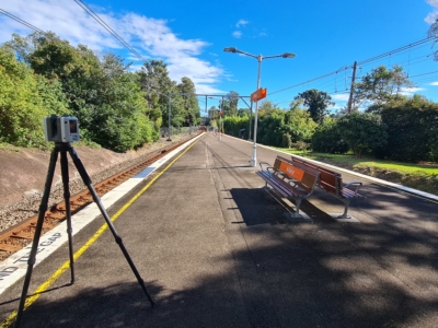
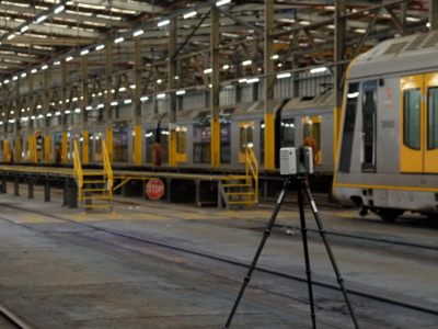
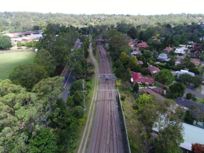
As-Built Survey of Train Station
Terrestrial laser scanning survey to produce as-built survey of train station for…
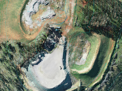
LiDAR Survey of Historic Mining Area
Drone-LiDAR Survey to develop a High resolution terrain model of historical mining…
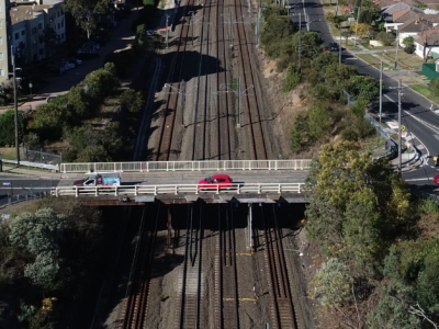
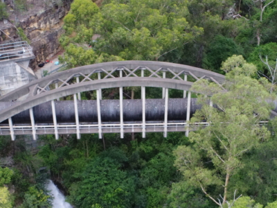
Laser Scanning of Bridge Road for Design
Laser Scanning survey and photogrammetry reality model of bridge and surrounding areas…
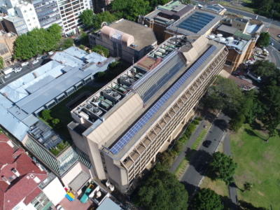
Laser Scanning and Inspection of Rooftop Plant Room
Laser Scanning and drone inspection for condition assessment and Survey of NSW…
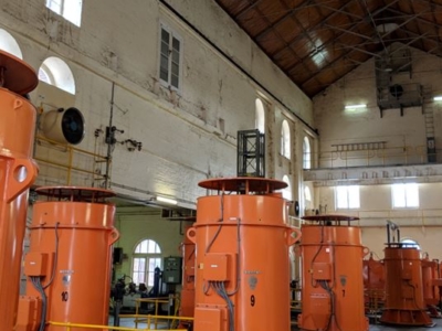
Pumping Station Reality Capture using Laser Scanning
Confined space Terrestrial Laser Scanning of sub-terranean pump wells for engineering design…
OHL Inspection and Monitoring using Laser Scanning
Laser Scanning and drone-inspection for OHL conformance and clearance monitoring PROJECT OVERVIEW…
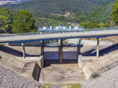
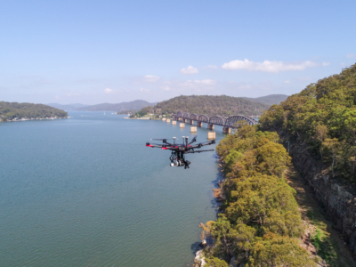
Photogrammetry and Imaging derived 3D Model for Spillway Bridge Inspection
Close visual inspection and 3D modelling of Spillway Bridge PROJECT OVERVIEW In…
Bridge Inspection and LiDAR derived Geotechnical Assessment of Abutments
Close visual Bridge inspection and LiDAR survey for geotechnical assessment of abutments…
Reality Capture using Photogrammetry for Slope Stabilisation works
Reality capture and Digital survey for slope stabilisation Works As Executed drawings…
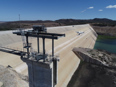
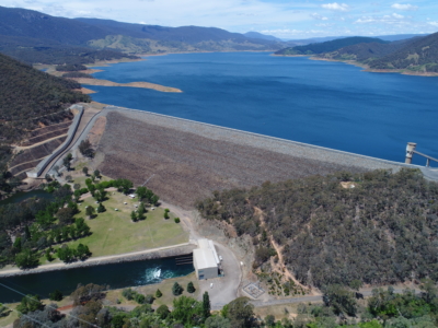
Inspection, Survey and Defect Mapping of Dam using Photogrammetry, Thermal IR and Imaging
High resolution inspection and defect mapping over more than 60,000m2 of concrete…
Drone LiDAR survey of HV Feeder for Vegetation Reporting
Drone LiDAR aerial scoping and vegetation reporting of newly constructed HV Feeders…
Drone survey of HV Feeders for Vegetation Defect Mapping
Vegetation defect mapping along 4km of HV Feeders within surburban rail corridoR…
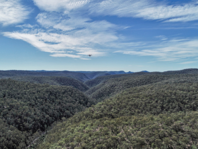
Geo-Hazard Mapping and Slope Risk Assessment
High resolution Drone-LiDAR survey for slope risk assessment of remote and densely…
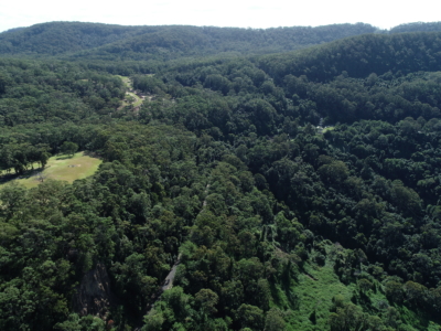
LiDAR Survey for Geotechnical Assessment
High resolution Drone LiDAR survey of Illawarra Escarpment for geotechnical assessment and…
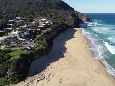
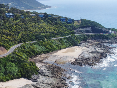
Coastal Erosion
A reasearch and development project utilising drone LiDAR and Photogrammetry for coastal…
Dam Defect Mapping
Drone-based inspection, digital defect mapping and precision aerial survey for one of…
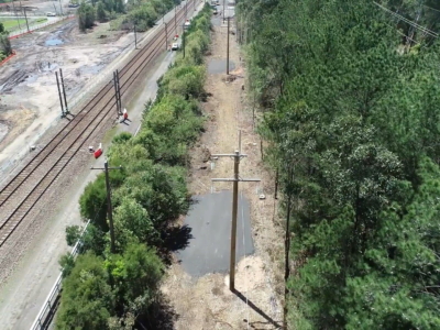
Rail Corridor Drainage Mapping
Drone LiDAR survey through dense vegetation to identify and Complete surface drainage…