Environmental Spatial Solution to Survey Rare Plant Species
Aerial survey of the leionema lachnaeoides rare plant species in the blue mountains national park.
PROJECT OVERVIEW
The Leionema Lachnaeoides is a rare plant species that is unique to the Blue Mountains National Park. Only 450 species were known to be in existence along a narrow band from 960-1000m altitude growing on exposed sandstone cliff tops and terraces.
NSW NPWS engaged Diospatial to locate and document locations of the rare plant as part of the “Save the Species” program.
DIOSPATIAL SOLUTION
Diospatial developed a drone based survey and inspection solution which saw a specialist remote pilot working alongside NPWS to complete an aerial survey and close visual inspection of the identified Blue Mountains region between Katoomba and Blackheath.
Using a multirotor drone, fitted with a high-powered camera with optical zoom and laser range finder, the Diospatial pilot flew the drone over the identified area while the NPWS representative observed the camera’s live feed on a secondary screen—enabling the representative to provide direction to the pilot on areas to focus and identify the rare plants that were of interest.
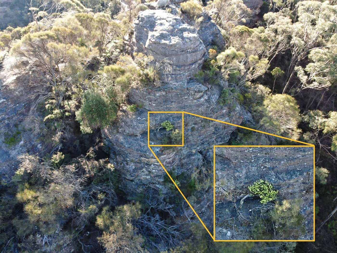
On positive identification of the target plant by NPWS, Diospatial’s remote pilot captured high resolution images of the plant, general images of the location and the geographic coordinates of the plant using the laser range finder equipped camera system.
The rare plant survey identified new populations beyond the known habitat extents and specimen sizes never before seen…
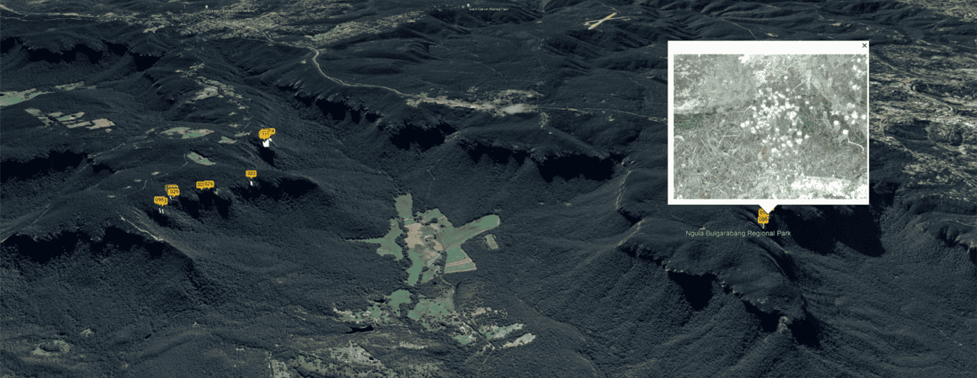
Plant images and coordinates (latitude, longitude and elevation) were compiled into a survey report.
In addition to this, Diospatial combined the images and plant coordinates into a Google Earth file which mapped the location of the identified plants. NSW NPWS can then use the Google Earth file as part of their in-field operations by using the exact coordinates of the identified species and real images of the plant location to help field crews find the plants on foot.
The survey resulted in the discovery of new plant populations including populations outside the known habitat extents and also identifying a number of specimens larger than previously observed.
The survey has proven so successful that similar surveys for other rare plants are planned for in the near future.
PROJECT SCOPE
Aerial Survey
Close Visual Inspection
Google Earth KMZ Mapping