Photogrammetry derived Reality Capture for Boardwalk Design and Geotechnical Assessment
High resolution drone LiDAR survey and Photogrammetry modelling for design of elevated coastal boardwalk and geotechnical assessment
PROJECT OVERVIEW
The popular walking route between Curl Curl and Freshwater passes over Freshwater Beach’s northern headland, where a series of sandstone outcrops and boulders present a geotechnical risk as well has some portions of the track becoming inundated during high tide and large seas. Re-design of the walking track, to address these issues, required a reality capture model and detailed topographic survey of the site for geotechnical assessment and identification of various hazards known to exist. A reality capture for boardwalk design solution was developed to support all stages of the design and planning process.
PROJECT SCOPE
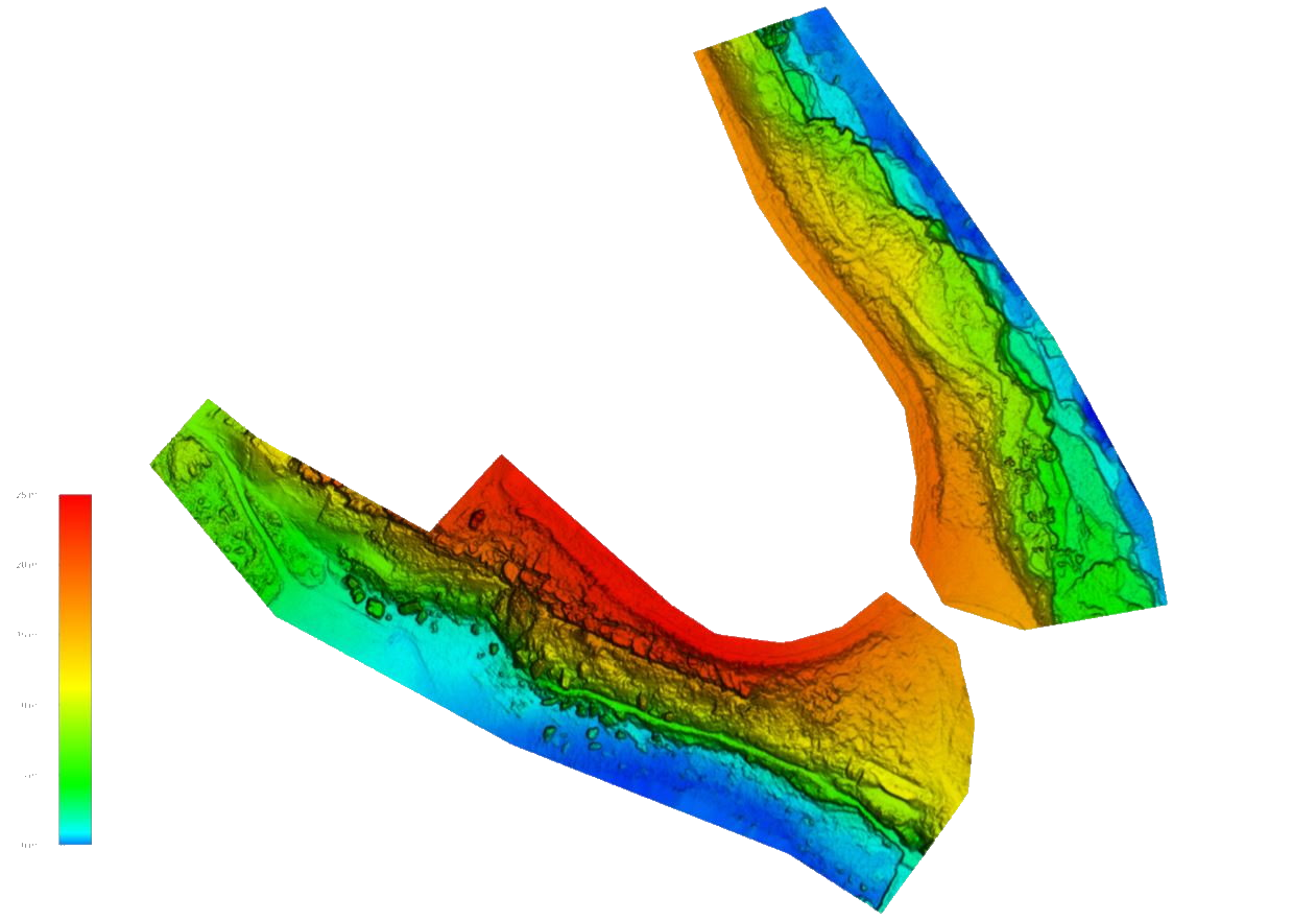
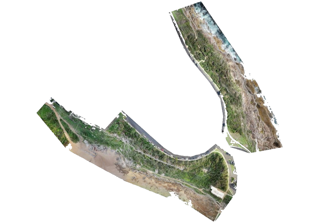
Drone-LiDAR and Photogrammetry
Topographic Survey
Digital Twin
DIODRONE SOLUTION
Diodrone developed a reality capture solution based on drone LiDAR and photogrammetry modelling and delivered a high resolution topographic survey and 3D reality model (digital twin), which were used to inform geotechnical risk assessment, design and significantly reduced the need for personnel to traverse the area on foot.
The combination of drone-LiDAR and photogrammetry provided high quality visualisation as well as reliable topographic survey.
The use of drone LiDAR, which was able to penetrate vegetation and measure the true ground surface, enabled Diodrone to develop a high-resolution digital terrain model. High-resolution-high-detail (HRHD) Photogrammetry modelling, which provides a photorealistic and scale accurate 3D reality model of the site, allowed stakeholders and engineers to inspect and assess the site in exacting detail, enabling the bulk of geotechnical risk assessment and design scoping to be conducted remotely reducing commercial risk and improving safety for the project.
The deliverables achieved an accuracy of better than 50mm RMSE and informed engineering decisions from design right through to construction.