Survey of Multiple Landslides
Combining drone lidar, photogrammetry and terrestrial laser scanning of multiple landslip sites to inform assessment, design and construction works.
PROJECT OVERVIEW
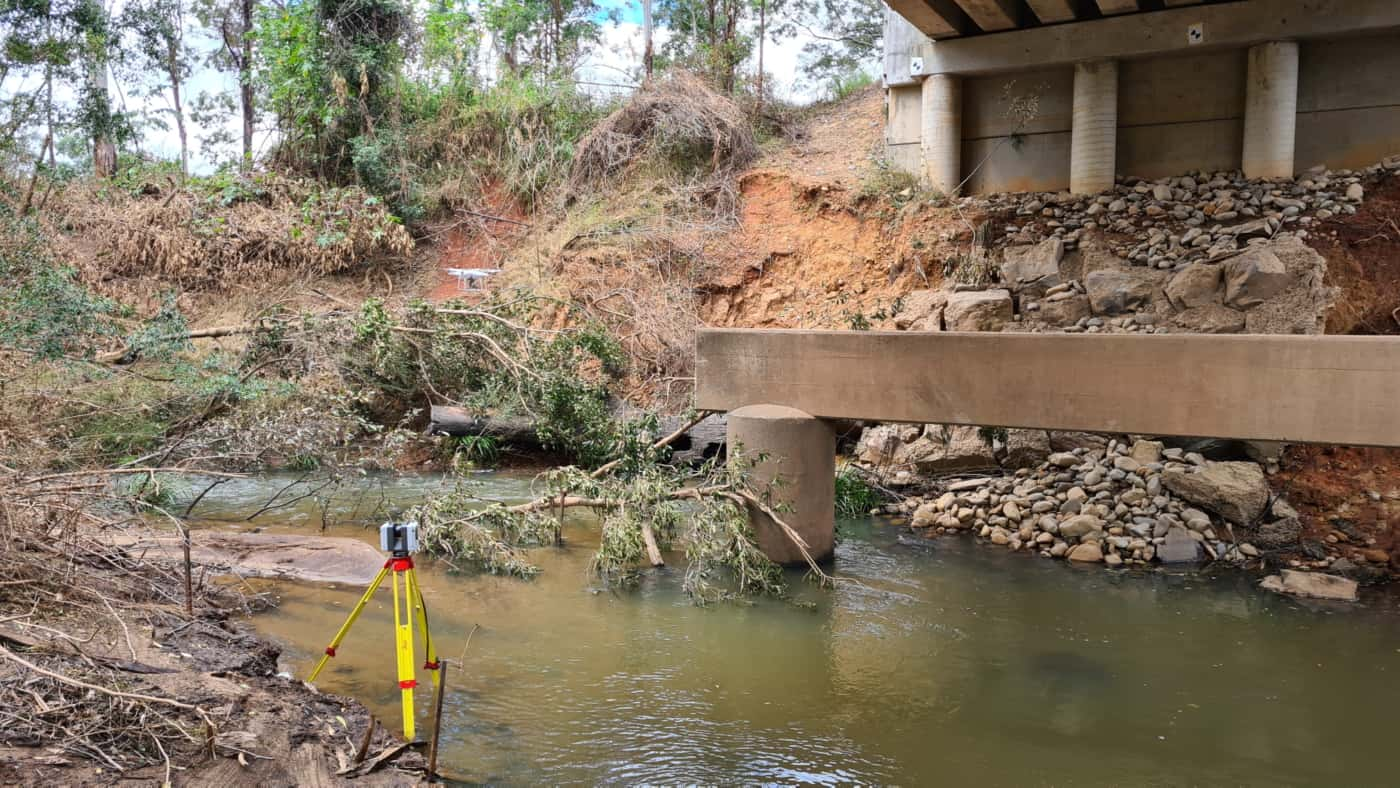
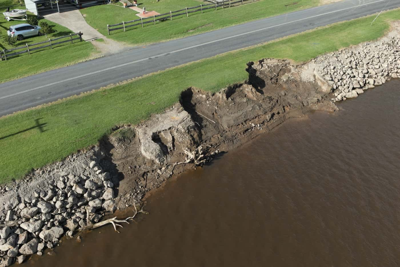
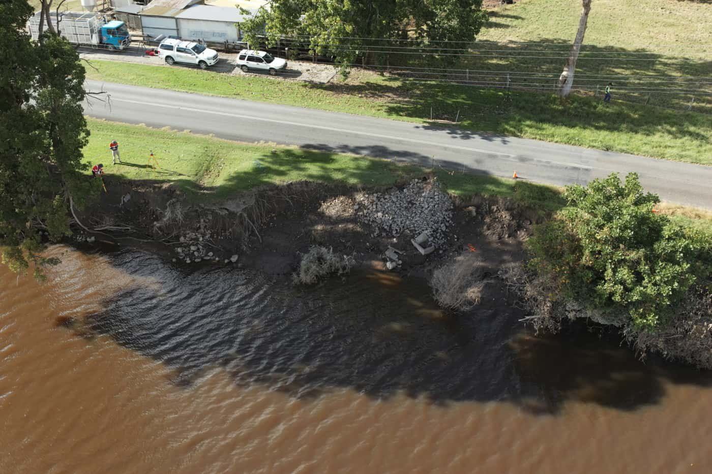
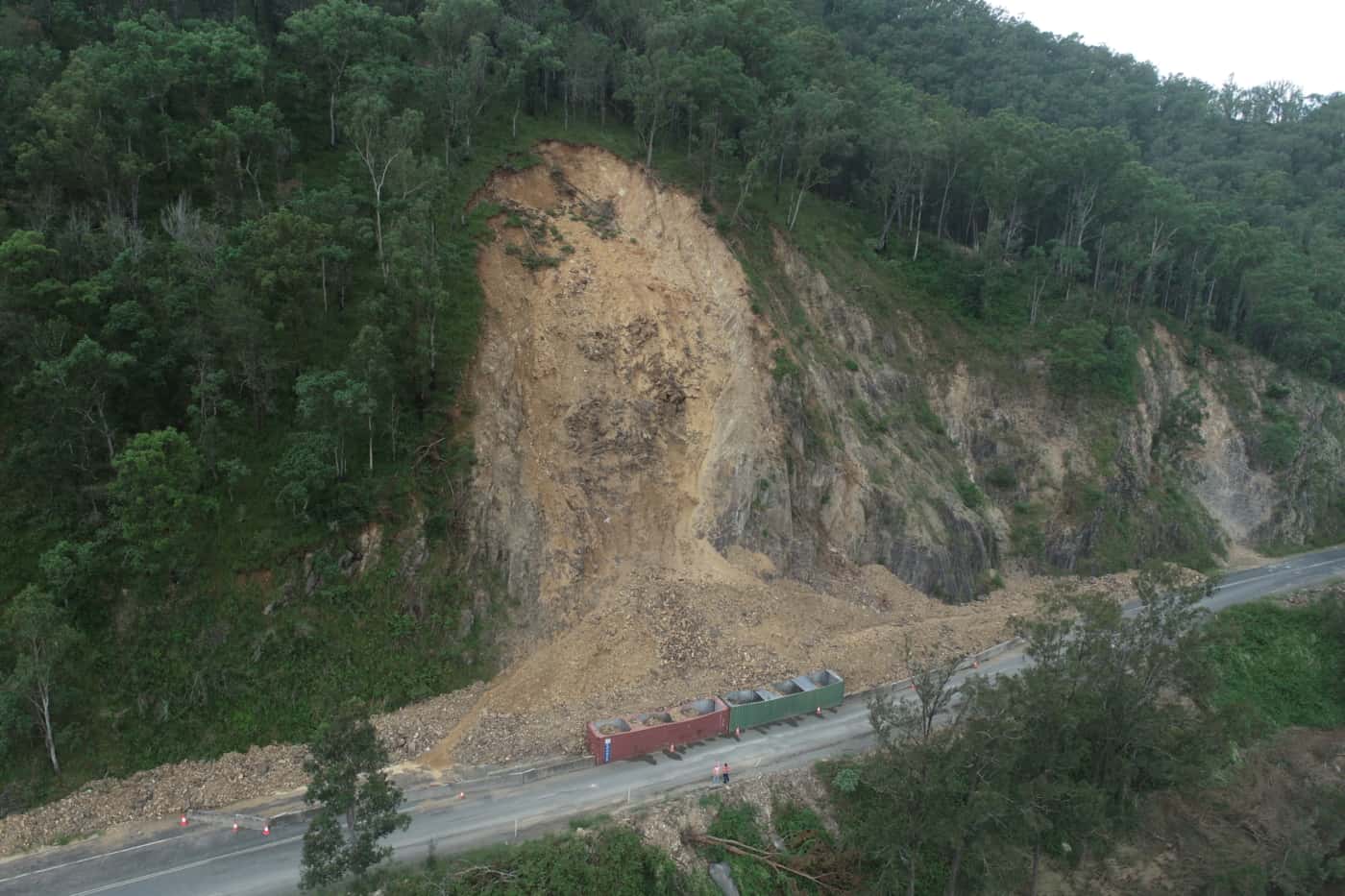
After excessive rainfall in NSW, multiple geotechnical hazards were identified at various locations. These ranged from significant landslips at roadside cuttings, collapsing creek embankments and soil erosion surrounding bridge footings.
Geospatial data was required to inform and assist with the geotechnical risk assessment and design of remediation works. Due to the varying locations, nature and size of the multiple geotechnical hazards, a customised surveying solution was required for each site.
PROJECT SCOPE
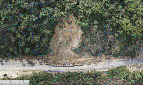
Aerial LiDAR & Photogrammetry
Terrestrial Laser Scanning
3D Reality Model
Terrain Modelling
DIOSPATIAL SOLUTION
Diospatial developed a bespoke geospatial solution that utilized a combination of capture technologies to acquire the geospatial data that was required. This included the use of high resolution drone LiDAR, photogrammetry modelling and terrestrial laser scanning.
Drone LiDAR/laser scanning were used to provide reliable terrain modelling across each of the sites, even where vegetation cover existed. The resulting high resolution point cloud was used to extract survey deliverables including digital terrain model (DTM), elevation contours, and rudimentary watershed analysis.
High resolution imagery was captured and processed in photogrammetry software to produce a high detail 3D reality model. This was used to provide reliable survey of rock exposures and rich visualisation for remote inspection. A 2D orthophoto was also produced to combine with LiDAR data for visualisation purposes.
By developing bespoke survey solutions for each site, the most relevant geospatial data was captured to inform the design and remediation planning.
For sites that involved roadways and bridges, terrestrial laser scanning was used to provide a precise point cloud, terrain mesh and colourised visualisation.
The spatial data was delivered in specialist software formats as well as compiled in to the 3D reality model. This was hosted on a web based GIS platform which allowed project stakeholders to easily visualise, share and collaborate.
By developing bespoke survey solutions that suited the conditions of each site, the best geospatial data was delivered to the project stakeholders to ensure they could accurately complete their geotechnical assessment and design planning.