Aerial Survey of Council Lookout for Geotechnical Assessment
Drone-LiDAR survey and 3D photogrammetry modelling of slopes and surrounding area of a popular council-owned lookout.
PROJECT OVERVIEW
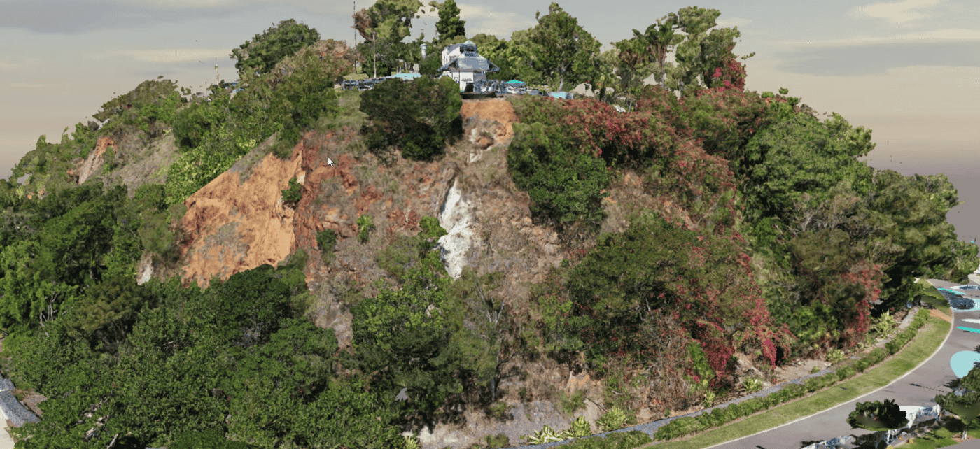
Diospatial was commissioned by consulting engineers to capture and provide survey deliverables of a popular council-owned lookout. The lookout was to be assessed for geotechnical risk and so the consulting engineers required spatial data of the land topography, as well as visual data of the site for inspection and site context.
Project Scope
Drone LiDAR & Photogrammetry
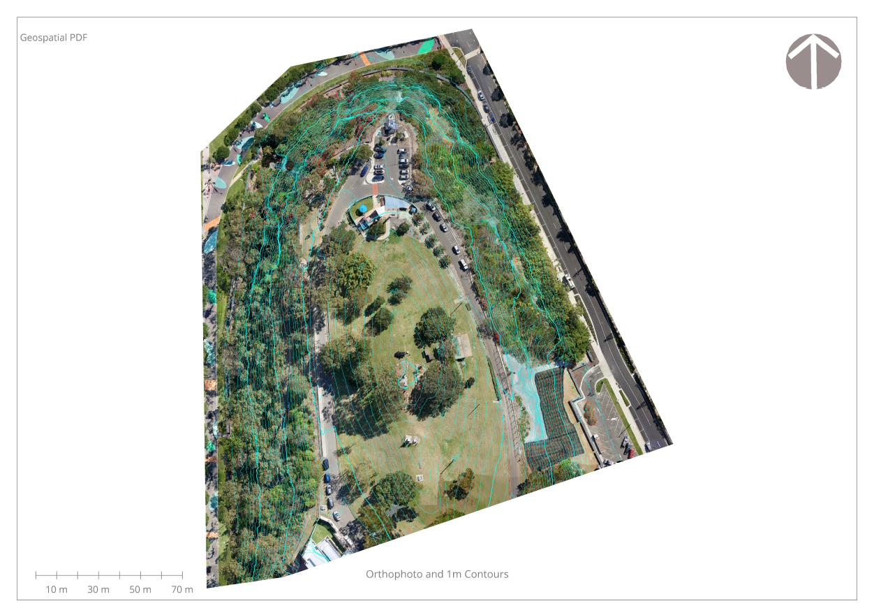
Geospatial PDFs
3D Model
DIOSPATIAL SOLUTION
Diospatial developed a drone-based solution to capture high resolution LiDAR for terrain modelling and photogrammetry data for visualization of site conditions.
Drone-based LiDAR data was captured and processed to create a point cloud. The point cloud was then classified and further processed to create a digital terrain model and elevation contours. These models were delivered as Geospatial PDFs which allowed the survey outputs to be viewed as map based PDFs and allowed the users to see their real time position on the map, add annotations, pin drops and more. This aided in-field works by providing clear positioning and visualisation
Topographic survey, detail survey and photogrammetry modelling were combined to produce a complete digital twin of the site for engineers.
High resolution aerial and oblique imagery was captured and then processed using photogrammetry software to produce a high detail 3D reality model. This was shared as a web hosted 3D model which allowed for easy sharing, interrogation and collaboration among project stakeholders.
The detailed spatial data outputs enabled the consulting engineers to complete remote geotechnical assessment, planning of remediation works and support in-field inspections.
Due to the popular nature of the site, Diospatial designed a capture methodology in line with CASA requirements while reducing the impact to pedestrians and daily activities to the location.