Geospatial Survey for Geotechnical Assessment
Drone LiDAR, photogrammetry modelling and geospatial analysis of rockfall and landslide to inform geotechnical risk assessment.
PROJECT OVERVIEW
After a large rockfall and landslide event, Diospatial was engaged to develop a geospatial survey solution to inform and assist the consulting engineer’s geotechnical risk assessment and possible future remediation design works. This required a detailed survey of the escarpment and surrounding hillside where the rockfall took place. Due to the heavily vegetated and hard to access nature of the site, conventional survey was not feasible. And so a geospatial survey for geotechnical assessment using drone based capture techniques was ideal.
Project Scope
Drone LiDAR & Photogrammetry
Geospatial Analysis
3D Model
DIOSPATIAL SOLUTION
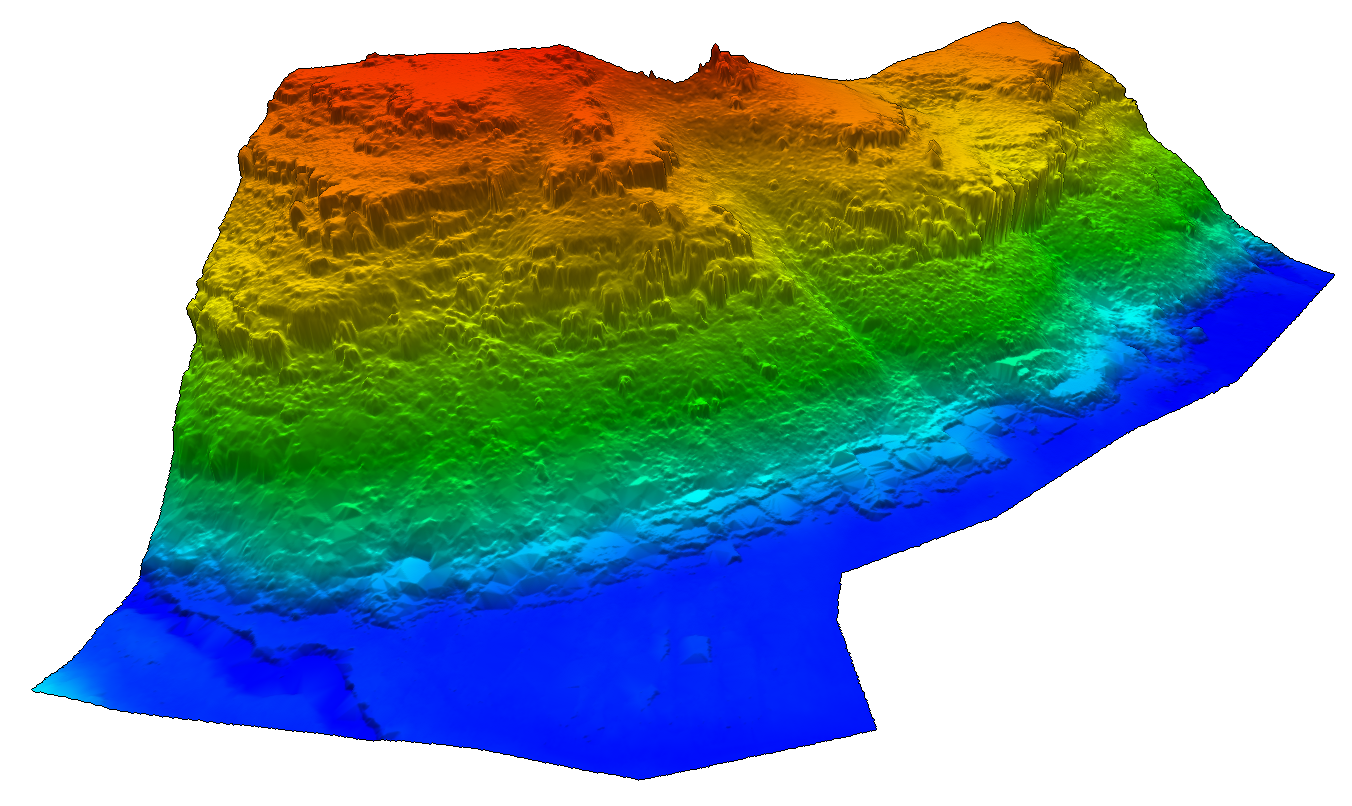
Diospatial developed a drone-based reality capture solution that combined LiDAR for topographic survey deliverables and Photogrammetry to provide a photorealistic 3D visualisation of the site.
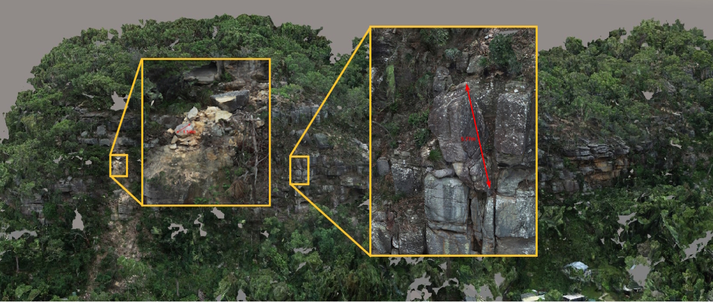
LiDAR was used to identify overhanging features and boulders, while photogrammetry provided a detailed and accurate view of the site conditions for inspection, measurement & assessment.
Drone LiDAR derived topographic survey outputs provided data for the identification and mapping of boulders, surface drainage and overhung topography beneath dense vegetation.
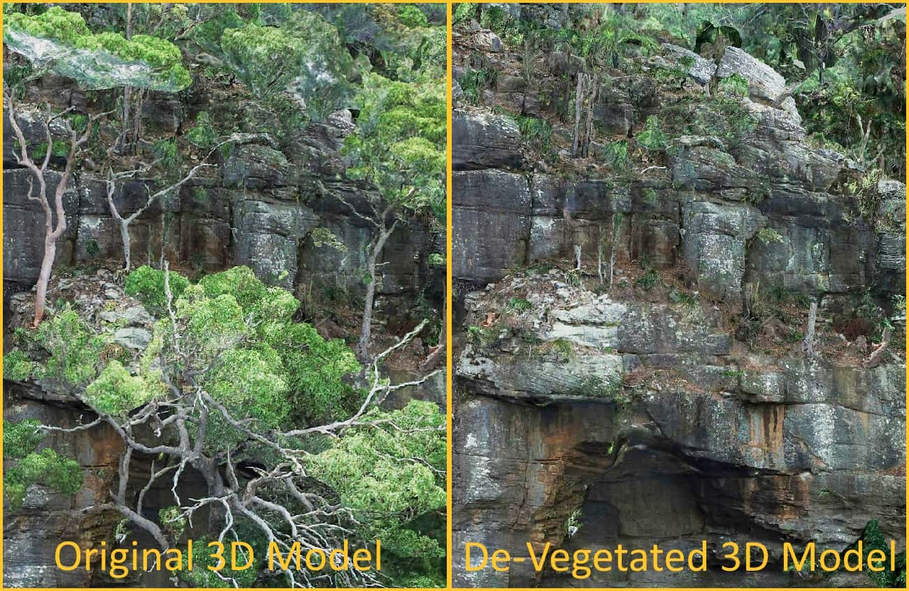
High resolution images were captured of the site and processed in photogrammetry software to produce a 3D digital twin. Photogrammetry provided a detailed visualisation of the site for close inspection of geological features. To provide greater visualisation, imagery was captured above and below the tree canopy and mesh-editing was completed in the photogrammetry model to allow for the creation of a de-vegetated reality model.
The geospatial outputs were hosted on a web-based 3D GIS platform, Pointerra. This allowed project stakeholders to visualize, interrogate and download data without the need for specialist software or powerful computing hardware.