Complete Spatial Solution for Geotechnical Assessment
LiDAR, photogrammetry and Laser Scanning of road corridor and landslip for geotechnical assessment and planning.
PROJECT OVERVIEW
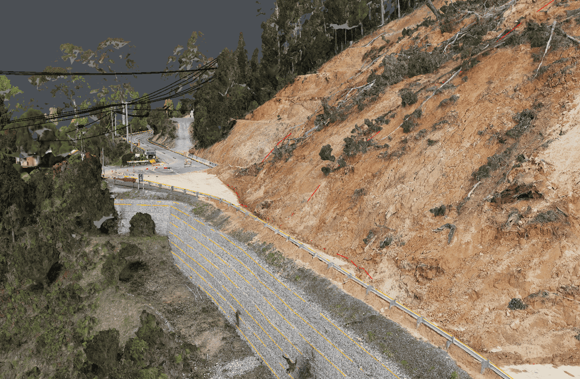
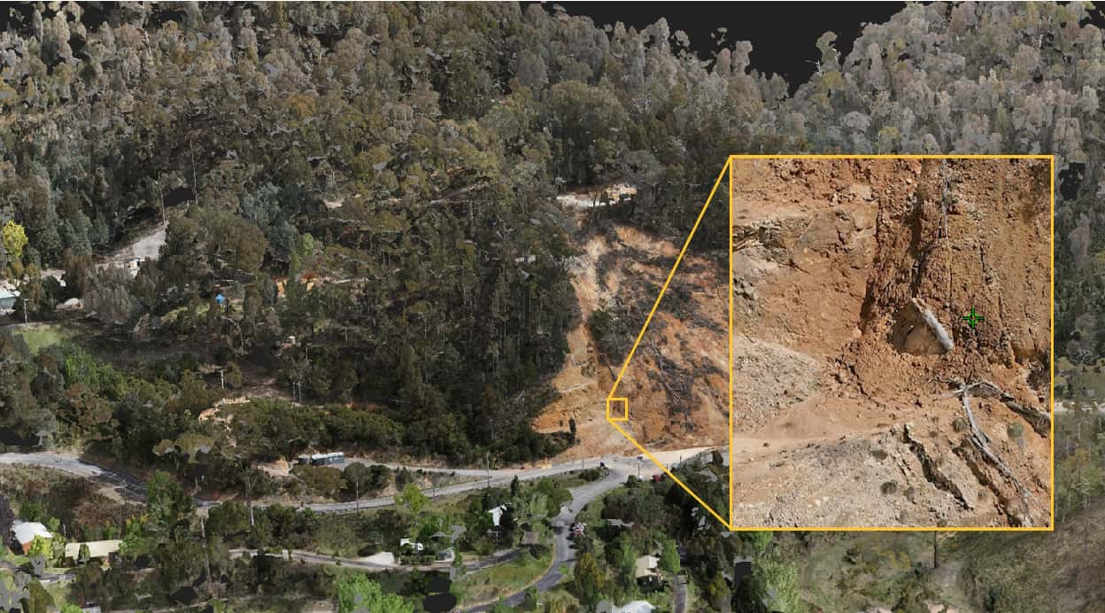
After a severe weather event, a landslip had occurred on a hillside and flowed on to the road below. This resulted in the closure of the road which was the main access to the nearby town and alpine regions, impacting locals and tourism. To support assessment, design and planning of remediation works, a complete spatial solution for geotechnical assessment was required to understand the terrain, accurately map infrastructure and site features, and provide detailed visualisation of the slip and surrounding areas.
Project Scope
Drone LiDAR & Photogrammetry
Terrestrial Laser Scanning
3D Model
DIOSPATIAL SOLUTION
Diospatial developed a complete spatial solution for geotechnical assessment that used multiple capture technologies including LiDAR, photogrammetry and terrestrial laser scanning, to produce a full geospatial survey deliverables.
Topographic survey, detail survey and photogrammetry modelling were combined to produce a complete digital twin of the site for engineers.
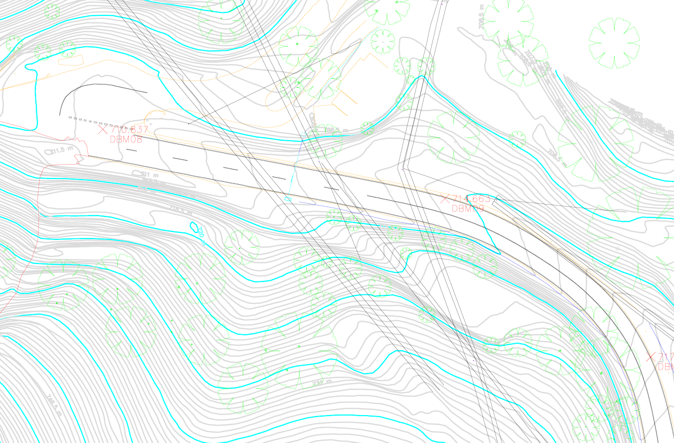
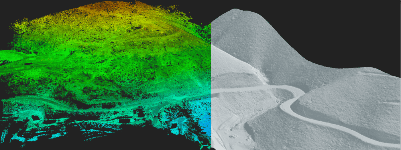
Drone LiDAR was used due to its ability to penetrate vegetation to capture the bare earth terrain beneath. Topographic survey outputs were then derived from the LiDAR point cloud, including DTM, elevation contours and surface mesh modelling. From this, further geospatial analysis was completed to produce rudimentary surface drainage analysis.
Terrestrial laser scanning was used to complete detail and level surveys to accurately extract features along the road corridor and produce linework.
High resolution images were captured by drone of the site and processed in photogrammetry software to produce a 3D model. The 3D model was scale accurate and geolocated so that it could be relied upon for geotechnical risk assessment.
A survey control network was established to ensure all survey deliverables were geospatially accurate and geolocated.
All geospatial data was hosted on a web based 3D GIS platform, Pointerra, which allowed users to visualize, interrogate and collaborate without the need for specialist software or powerful computing hardware.
The accuracy of the model was approximately 50mm RMSE.