Drone Survey for Landslip Assessment
Drone LiDAR and photogrammetry survey of landslip area to identify extent of landslip beneath vegetation.
PROJECT OVERVIEW
After a landslip event resulted in the closure of a road, the local council engaged an engineering firm to complete a geotechnical assessment and complete design of remediation works to enable the reopening of the roadway. The engineering firm suspected the geotechnical risk was greater than what was visibly evident, and so they required a drone survey for landslip assessment. The drone survey was required to produce terrain modelling to understand the extent of the landslip and a scale accurate 3D model of the site to provide visualisation for planning and design of remediation works.
Project Scope
Drone LiDAR & Photogrammetry
Surface Mesh + Feature Extraction
3D Model
DIOSPATIAL SOLUTION
Diospatial developed a drone based capture methodology that utilized LiDAR for topographic survey deliverables, and high resolution images processed in photogrammetry software to produce a high detail 3D model.
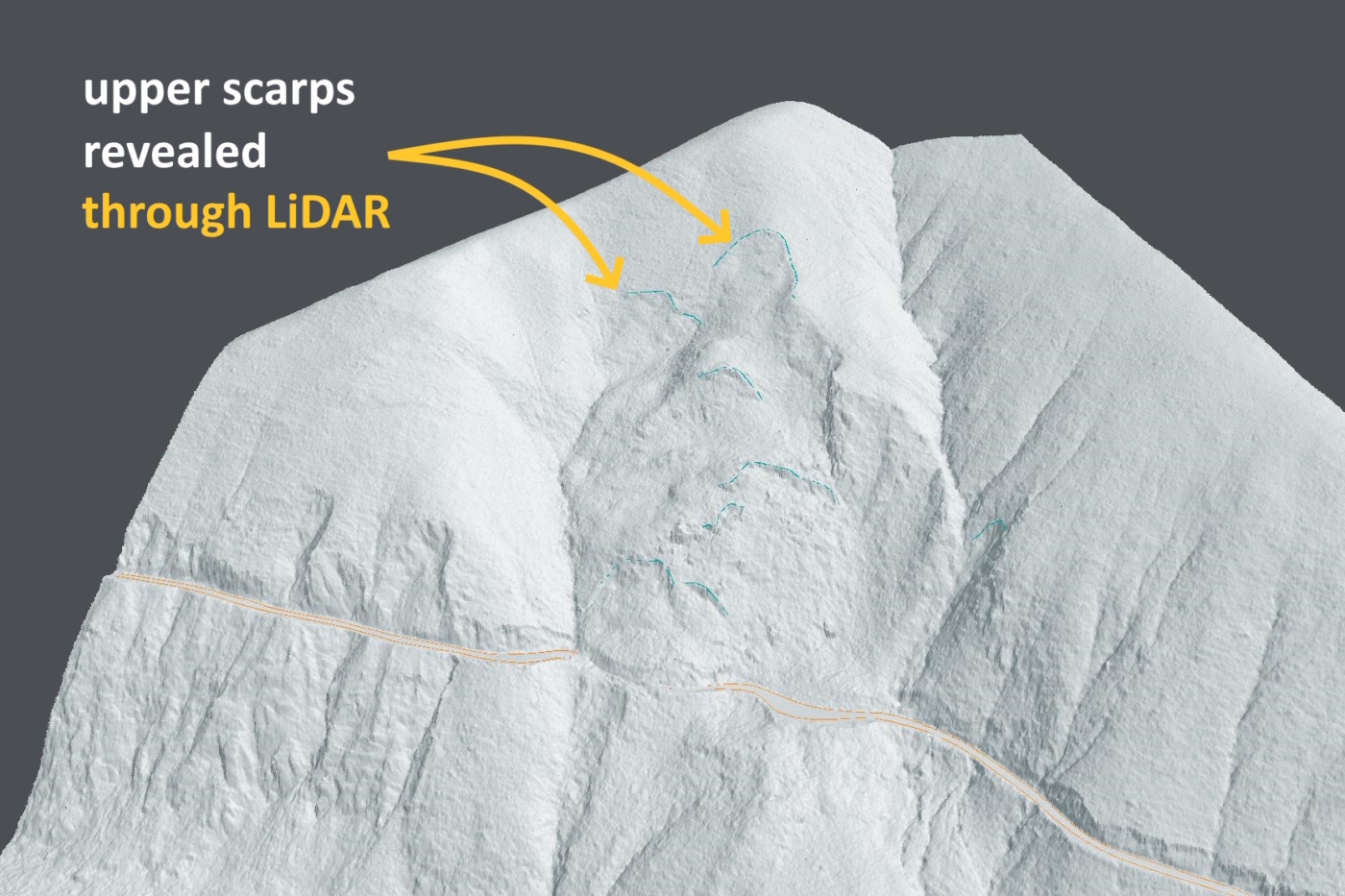
Drone LiDAR was used for its ability to penetrate vegetation and to efficiently cover a large area. The LiDAR survey was captured at a high point density and the point cloud was classified for ground and non-ground points. From this, the digital terrain model (DTM) could be produced, which was then used to derive elevation contours, surface drainage, and extract key features.
High resolution images were captured of the site and processed in photogrammetry software to produce a 3D digital twin. The scale-accurate digital twin provided rich visualisation of the site to support inspection and remote planning of remediation works. The images were also used to produce an orthophoto of the site.
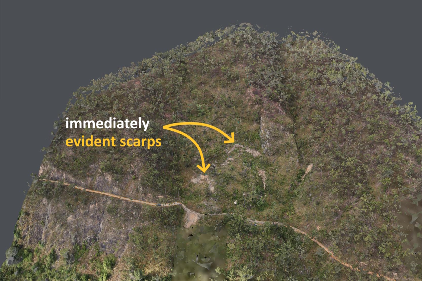
The LiDAR derived surface mesh model showed the extent of the landslip was greater than what was visible to the naked eye.
A survey control network was established to check and verify the geolocation and scale accuracy of the model. The accuracy of the LiDAR data was +/-30mm RMSE, and the average resolution of the 3D model was 11mm/pixel.
From the LiDAR survey, scarp and landslide features were evident beneath vegetation, as was suspected by consulting engineers, but not visible from road level.
The geospatial outputs were hosted on a web-based 3D GIS platform, Pointerra. This allowed project stakeholders to visualize, interrogate and download data without the need for specialist software or powerful computing hardware.