Geospatial Survey of Roadway Landslide
Using Drone Lidar and photogrammetry to inform geotechnical Risk assessment and design after severe weather event.
PROJECT OVERVIEW
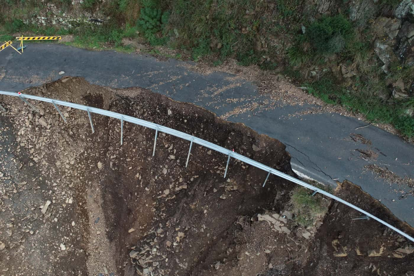
After the March 2021 severe weather event, a significant landslide had occurred on a steep road cutting, resulting in the closure of the roadway.
Geospatial data was required to inform and assist with the geotechnical risk assessment and design planning to enable the road to be reopened. Due to the geotechnical risk present, conventional survey means was not possible.
PROJECT SCOPE
Aerial LiDAR & Photogrammetry
3D Reality Model
Digital Terrain Model
DIOSPATIAL SOLUTION
Diospatial developed a drone-based solution that utilised high resolution aerial LiDAR to capture reliable bare earth terrain data, and high detail photogrammetry to provide rich visualisation of the roadway landslide.
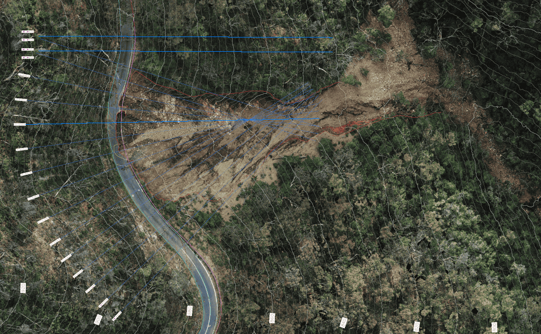
Aerial LiDAR was captured using a large multirotor drone. The resulting high resolution point cloud was used to extract survey deliverables including digital terrain model (DTM) and elevation contours.
High resolution imagery was captured and then processed in photogrammetry software to produce a high detail 3D reality model. This enabled the client to complete a visual geotechnical assessment safely. A 2D orthophoto was also produced to combine with LiDAR data for visualisation purposes.
Drone LiDAR and photogrammetry captured the ideal geospatial data to complete a robust geotechnical assessment.
Feature extraction and linework was completed using both the LiDAR and photogrammetry derived data outputs. From this, drafting sheets were produced of the site in plan view, elevation view and cross-section.
The spatial data was delivered in specialist software formats as well as compiled in to the 3D reality model. This was hosted on a web based GIS platform which allowed project stakeholders to easily visualise, share and collaborate as they completed the geotechnical assessment and design solution.
The drone-based geospatial survey solution of the roadway landslide ensured the geotechnical assessment could be completed safely while ensuring all site conditions were captured.