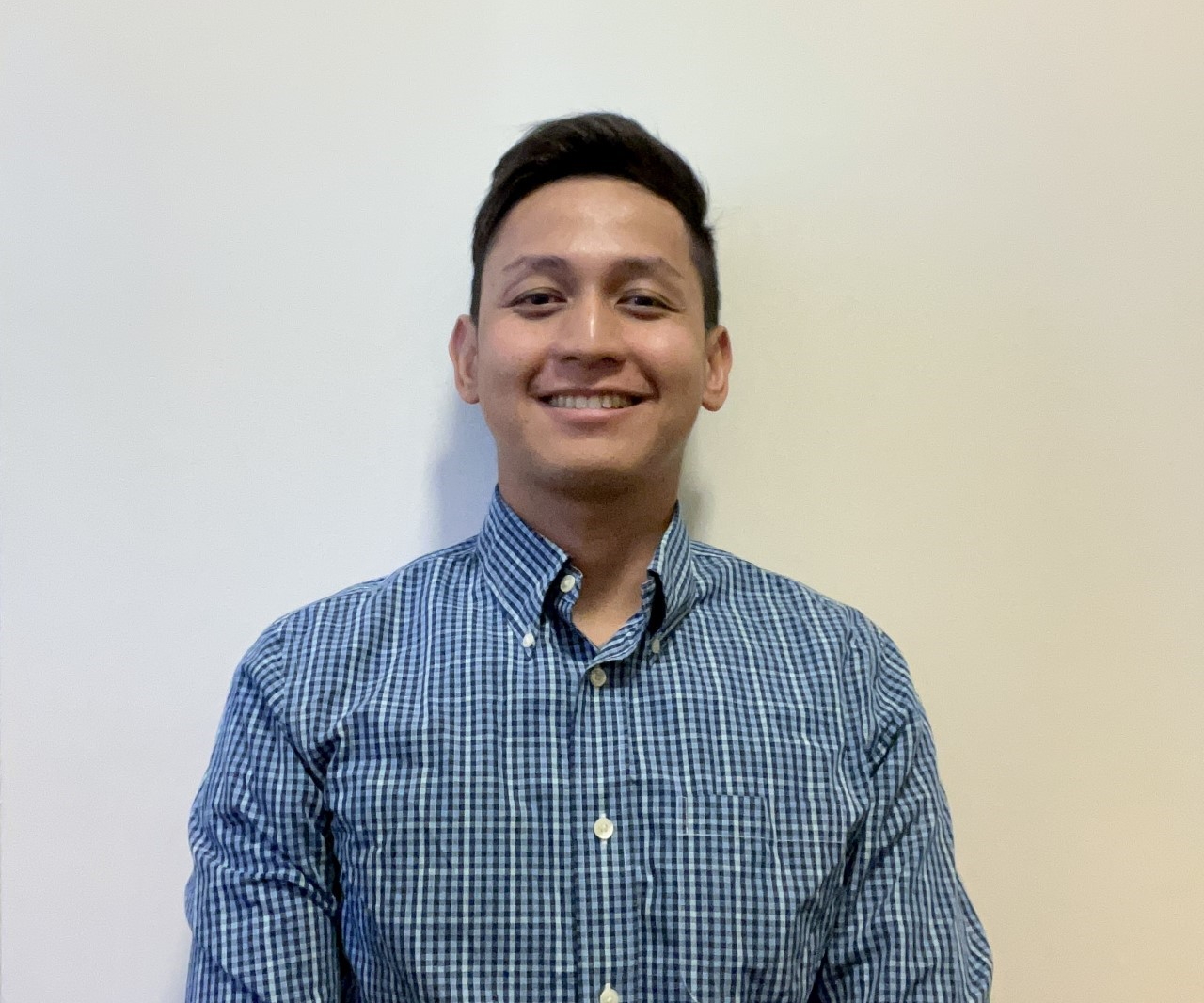
Meet the D-Team Series: Kevin Gonzales
In our latest Meet the D-Team Series, we are welcoming Kevin Gonzales as our new Geospatial Surveyor at Diospatial.
Kevin started his geospatial career as a GIS Specialist in the Philippines. His first role was working on feature extraction which sparked his passion for spatial science, setting him off on a course to learn as much as he could about geospatial analysis. Since then, he has been unstoppable, working on large infrastructure projects in Australia, specialising in engineering survey, laser scanning and photogrammetry-based reality capture, and eventually training to become a UAV pilot.
We caught up with Kevin for a quick Q&A to get to know more about his career to date, the latest advances in the industry that he’s excited about and what he sees as the biggest value digital engineering is adding to surveying.
Tell us a little bit about your surveyor career so far…
I finished my degree in Geodetic Engineering in the Philippines way back in 2015 and soon afterwards landed my first job as a GIS Specialist. I was working on feature extraction for the country’s hydrologic database and from then on, I pretty much knew what career I wanted to have moving forward.
I decided to move to Australia early 2016 to work for big surveying companies in the country. During that time, I was a project surveyor on some of NSW’s high-profile projects which solidified my passion to continue progressing in the field of spatial sciences. Around 2019, I received some terrestrial laser scanning projects and got more involved in the geospatial department of my company. I had always showed an interest in the field and with some luck the company landed some big projects working on UAV and laser scanning. From there, the job brought me to some remote places of NSW and I became one the few UAV pilots in the east coast branch.
Tell us about a standout project that you worked on…
I would say one of the most standout projects I have done in my career was the digital twin modelling of 110 telecommunication towers for a big electric distribution company in NSW. It was a project new to the company and the methodology was still uncertain at that time. The main goal was to produce two separate models – one from terrestrial laser scanning and the other using UAV drone photos. At that time, digital twin management was slowly gaining popularity as people saw the usefulness of having the data available for asset management, renovation and maintenance. The tower’s heights ranged from 10 meters all the way up to 100 meters which made it difficult to capture a very detailed model of the asset. The team had to use various methods in UAV drone capture such as doing an up-and-down method to gradual decent while orbiting the tower. We were then able to come up with a methodology that effectively captured the tower while minimizing the time to process the photos. Meanwhile, laser scanning wasn’t a walk in the park either – the height of the tower was something to consider especially when it came to the range limit of the instrument we were using. It took us a few test runs and a lot of combinations between different scan settings to produce a very detailed model. In addition to that, the towers were located in high elevation places which brought us to very remote places where public were not allowed. We managed to complete all the towers and I can say it was truly one-of-a-kind project. It really opened my eyes to a lot of the possibilities and applications of these technologies in the future to come.
What are some of the advances in reality capture and surveying that have you most excited?
I’m really excited about the advancement of digital twin management in the future. A few decades ago, drones were merely used for military purposes, but nowadays – it has proven its use in agriculture, mining, conservation, etc. Imagine UAV data getting the accuracy of traditional survey methods in the years to come, and integrating different survey techniques to produce detailed models. It is truly a field with limitless possibilities.
What do you see is the biggest value that digital engineering is adding to surveying?
I think the biggest value added by digital engineering is giving more detailed information in less amount of time. Cliché it may sound, traditional survey will always be required but reality capture has taken it to another level which best suits the needs of the clients. And as a company, we want to ensure that we deliver the best possible outcomes for every project we’re involved in.
Who inspires you most in the industry? Company or Individual…
I think the company that has inspired me lately is Nearmap. I was amazed on some of the quality of photos they currently have which varies on different timelines. I’m sure the extent of coverage will be greater in the future, but it shows how fast technology advances from time to time and I’m excited to see what innovations we will have in a decade or so.
What did you do in lockdown to stay sane?
I spent a lot of time playing online games and trying new recipes to add to my cookbook. I’ve always tried to be a good cook but it has been hit or miss most of the time.
Which do you prefer – books, YouTube, or podcasts?
I’m very interested in watching YouTube videos about how things were made, ranging from food to intricate building designs.
What is the most daring thing you have ever done?
Still on top of my list would be skydiving here in Australia. I never imagined before that I’d be able to do it and definitely will never do it again.
If you weren’t a surveyor, what would you be?
If I wasn’t a surveyor I would probably be a Zookeeper. All of my friends know that if I’m not successful in this field, I would try my luck working with animals.
Welcome to the Diospatial team, Kevin!
Keen to get in touch with the D-Team?