Photogrammetry Modelling of a Bridge
High detail photogrammetry modelling of a bridge for heritage archives.
PROJECT OVERVIEW
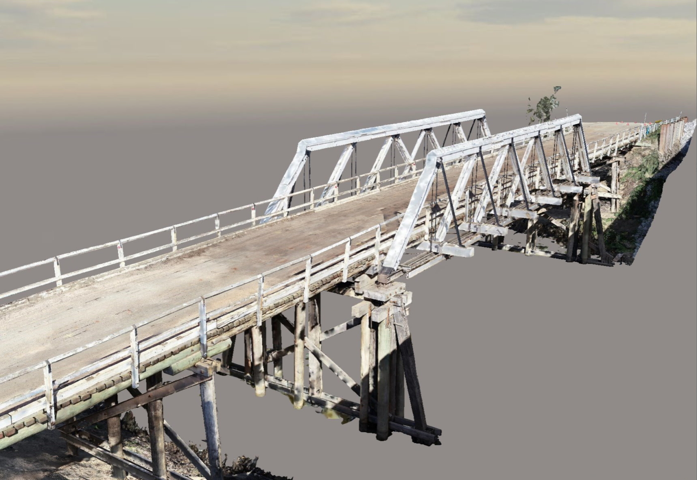
Gee Gee Bridge is a heritage-listed timber truss road bridge which was built in 1929. It links Deniliquin in NSW and Swan Hill in Victoria over the Wakool River.
The Gee Gee Bridge was identified for replacement as the bridge no longer met current road standards. As part of the bridge replacement project, the old Gee Gee bridge was to be removed and relocated.
Western Sydney University contacted Diospatial to create a digital record of the heritage-listed bridge before it was removed.
Project Scope
Drone Photogrammetry
Terrestrial Reality Capture
Web-Hosted 3D Model
DIOSPATIAL SOLUTION
Diospatial developed a bespoke reality capture solution that combined both aerial (drone) and terrestrial (handheld) imagery data capture, which was then processed in photogrammetry software to produce a photogrammetry modelling of a bridge.
Ground control was established with GNSS base and rover to ensure the resulting 3D model was scale accurate.
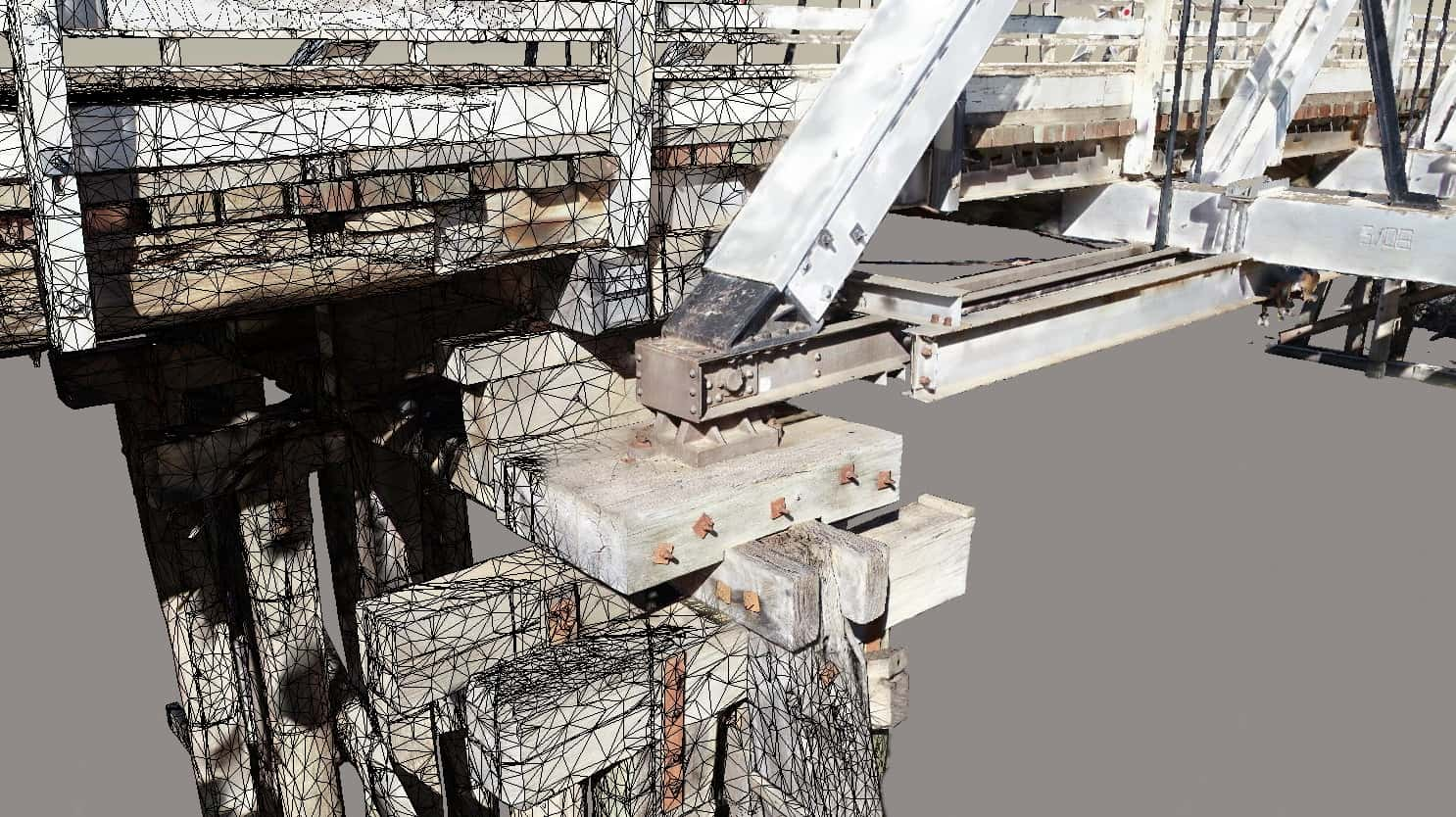
Aerial images were captured across the majority of the bridge structure, while handheld imagery was captured to supplement the drone imagery and provide improved detail of the underdeck elements.
The photogrammetry modelling of a bridge produced a scale accurate 3D model of the heritage-listed bridge to keep a record in time.
The images were then processed in photogrammetry software to create a 3D textured mesh and high density point cloud. The resulting photogrammetry model of bridge was hosted on a web-based portal for easy access and visualisation of the 3D model.
In addition to the 3D photogrammetry modelling of a bridge, spherical panoramas of the bridge were captured on the upstream and downstream aspects to show the site context.
The data capture was completed over 1 day on-site and achieved an average ground resolution of 2.9mm per pixel across 4,319no. images. The resulting photogrammetry model achieved an accuracy of 1.3mm RMSE. Providing a scale accurate 3D digital model of a heritage listed bridge to be kept as a record of history.