• Sectors
    Toggle Dropdown
    • Rail
    • Road
    • Water
    • Land Management
    • Resources
    • Energy
    • Construction
  • Services
    Toggle Dropdown
    • Reality Capture
    • Drone LiDAR Survey & Photogrammetry
    • Survey & Laser Scanning
    • Inspection
    • Geospatial
    • CAD & Revit
  • Technologies
    Toggle Dropdown
    • LiDAR
    • Photogrammetry
    • Laser Scanning
    • Imaging
  • About
    Toggle Dropdown
    • The Diospatial Difference
    • Our Story
  • News & Updates
    Toggle Dropdown
    • Past Projects
    • Blog
  • Contact Us
    Toggle Dropdown
    • Careers
Diodrone
  • Sectors
    Toggle Dropdown
    • Rail
    • Road
    • Water
    • Land Management
    • Resources
    • Energy
    • Construction
  • Services
    Toggle Dropdown
    • Reality Capture
    • Drone LiDAR Survey & Photogrammetry
    • Survey & Laser Scanning
    • Inspection
    • Geospatial
    • CAD & Revit
  • Technologies
    Toggle Dropdown
    • LiDAR
    • Photogrammetry
    • Laser Scanning
    • Imaging
  • About
    Toggle Dropdown
    • The Diospatial Difference
    • Our Story
  • News & Updates
    Toggle Dropdown
    • Past Projects
    • Blog
  • Careers
  • Contact Us

building

  • All
  • Imaging
  • Inspection
  • Laser Scanning
  • Reality Capture
  • Survey & Laser Scanning

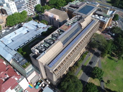
Laser Scanning and Inspection of Rooftop Plant Room

January 29, 2021

Laser Scanning and drone inspection for condition assessment and Survey of NSW…

Read more
Make an Enquiry
© Diospatial 2023
info@diospatial.com.au
  • Linkedin
  • Youtube
Digerati Solutions