• Services
    • Drone Survey
    • Photogrammetry Modelling
    • Bathymetric survey
    • Laser Scanning & Survey
    • BIM Modelling
    • Geotechnical Survey
    • Dilapidation Survey
    • Inspection
    • Change Detection & Monitoring
    • As-Built Survey
  • Sectors
    • Rail
    • Road
    • Water
    • Land Management
    • Resources
    • Energy
    • Construction
  • About
    • The Diospatial Difference
    • Our Story
    • Our Technologies
    • Capability Statements
    • News
  • Careers
  • Past Projects
  • Contact Us
Diodrone
  • Services
    • Drone Survey
    • Photogrammetry Modelling
    • Bathymetric survey
    • Laser Scanning & Survey
    • BIM Modelling
    • Geotechnical Survey
    • Dilapidation Survey
    • Inspection
    • Change Detection & Monitoring
    • As-Built Survey
  • Sectors
    • Rail
    • Road
    • Water
    • Land Management
    • Resources
    • Energy
    • Construction
  • About
    • The Diospatial Difference
    • Our Story
    • Our Technologies
    • Capability Statements
    • News
  • Careers
  • Past Projects
  • Contact Us

pole top inspection

IMAGE_Northern-HV-Feeders-3
  • Rail
  • All
  • Energy
  • Imaging
  • Inspection

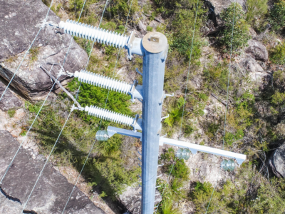
Aerial Scoping and Inspection of HV Feeders

October 20, 2020

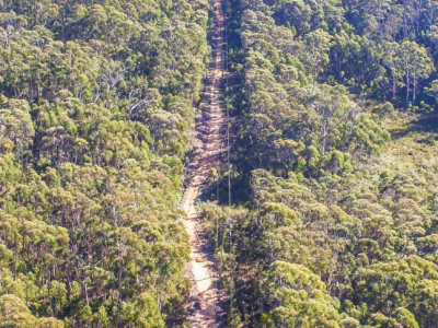
Drone based aerial scoping of HV Feeders throughout low access-high risk areas…

Read more
IMAGE_HV-Feeders
  • Rail
  • All
  • Energy
  • Inspection
  • LiDAR

HV Feeders Inspection

May 30, 2019

Aerial scoping and inspection of HV Feeders throughout low access-high risk areas…

Read more
Make an Enquiry
© 2025 Diospatial.
info@diospatial.com.au
  • Linkedin
  • Youtube