• Services
    • Drone Survey
    • Photogrammetry Modelling
    • Bathymetric survey
    • Laser Scanning & Survey
    • BIM Modelling
    • Geotechnical Survey
    • Dilapidation Survey
    • Inspection
    • Change Detection & Monitoring
    • As-Built Survey
  • Sectors
    • Rail
    • Road
    • Water
    • Land Management
    • Resources
    • Energy
    • Construction
  • About
    • The Diospatial Difference
    • Our Story
    • Our Technologies
    • Capability Statements
    • News
  • Careers
  • Past Projects
  • Contact Us
Diodrone
  • Services
    • Drone Survey
    • Photogrammetry Modelling
    • Bathymetric survey
    • Laser Scanning & Survey
    • BIM Modelling
    • Geotechnical Survey
    • Dilapidation Survey
    • Inspection
    • Change Detection & Monitoring
    • As-Built Survey
  • Sectors
    • Rail
    • Road
    • Water
    • Land Management
    • Resources
    • Energy
    • Construction
  • About
    • The Diospatial Difference
    • Our Story
    • Our Technologies
    • Capability Statements
    • News
  • Careers
  • Past Projects
  • Contact Us

line work

Drone LiDAR survey of roadside cuts and slopes
  • Geospatial
  • All
  • Geotechnical Survey
  • Land Management
  • LiDAR
  • Photogrammetry
  • Reality Capture
  • Road
  • Survey & Laser Scanning

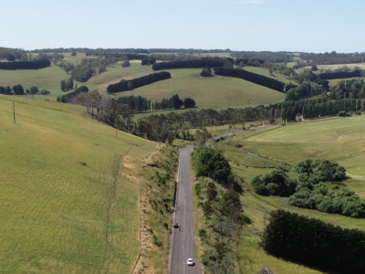
LiDAR Survey of Roadside Cuts and Slopes for Stabilisation Designs

January 14, 2021

Drone-LiDAR derived topographic survey and photogrammetry modelling for slope stabilisation designs PROJECT…

Read more
Make an Enquiry
© 2026 Diospatial.
info@diospatial.com.au
  • Linkedin
  • Youtube