Bathymetric and Topographic Survey
Hydrological and terrain modelling of river embankment and adjacent road to support geotechnical assessment of landslip for remediation design.
PROJECT OVERVIEW
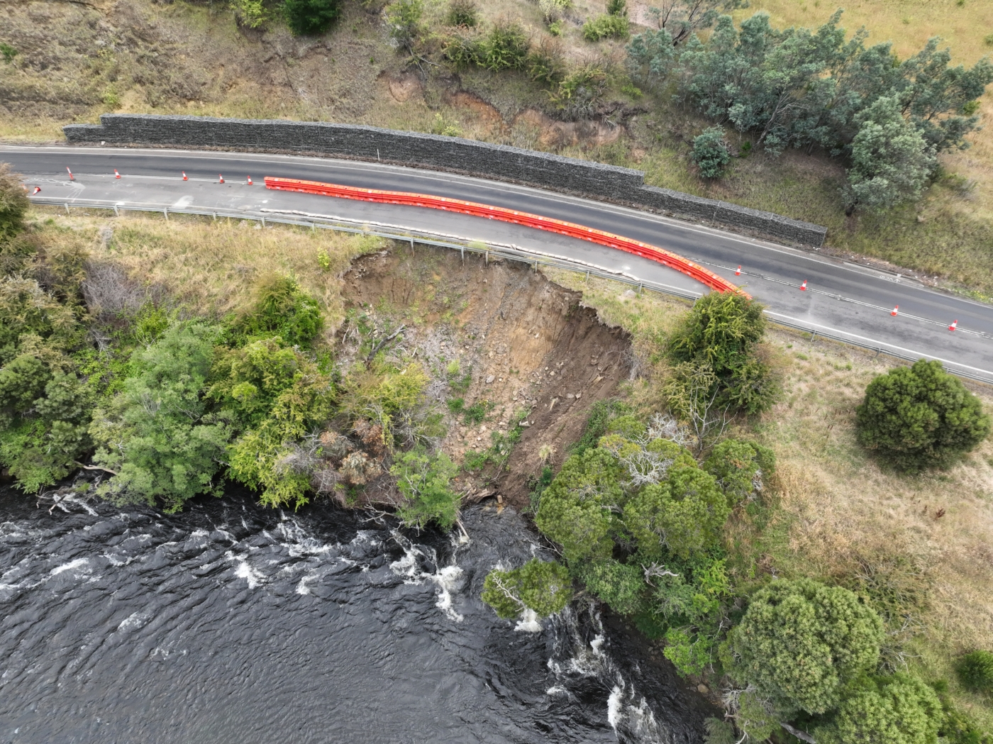
Diospatial was engaged to complete a topographic and bathymetric survey of the terrain above and below the waterline along 1km of the highway and adjacent riverbank.
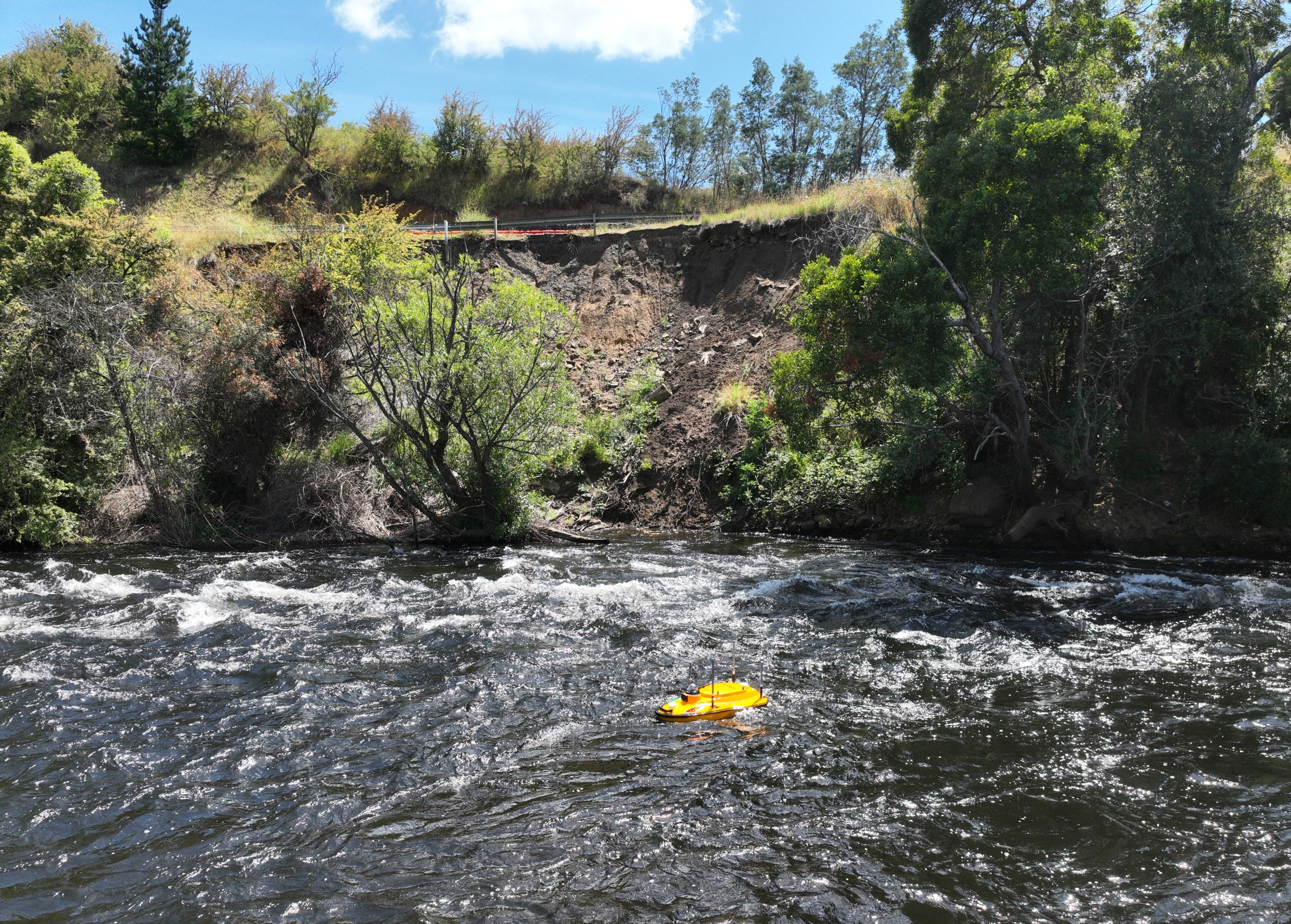
Due to the swift moving current and variable depths of the river, conventional depth and spot elevation measurements were not feasible. An unmanned vehicle solution was therefore required.
Scope
Unmanned Surface Vehicle
Unmanned Aerial Vehicle
Terrain Modelling
DIOSPATIAL SOLUTION
Diospatial developed an unmanned vehicle solution that captured both a topographic and bathymetric survey.
BATHYMETRY
An unmanned surface vehicle (USV) equipped with a single beam echo sounder (SBES) was used to capture the terrain beneath the waterline and complete the bathymetric survey. The USV (boat) was able to operate in water depths of >0.2m and in fast-flowing currents, making it ideal for the site conditions. The soundings were georeferenced to MGA2020 to tie in with existing detail survey of the road and embankment.
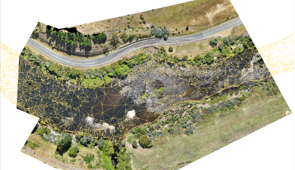
The topographic and bathymetric survey were processed and integrated into a unified terrain model, and then combined with other reality capture data sets to provide a complete geospatial solution.
tOPOGRAPHY
Areas above the waterline were captured using drone-LiDAR for its ability to penetrate vegetation and capture the terrain beneath.
For water depths of <0.2m with safe access, infill spot elevations were picked up to ensure complete coverage of the area.
The topographic and bathymetric survey data sets were processed and integrated into a unified terrain model to provide a complete picture for consulting geotechnical engineers.
PHOTOGRAMMETRY
High resolution imagery was captured and processed in photogrammetry software to produce a 3D reality model. This was used to provide rich visualisation of the site to support remote inspection and planning of remediation works.
FINAL DELIVERABLES
The final deliverables included a classified point cloud, digital terrain model (DTM), TIN, contours, 3D reality model and orthophoto.
All geospatial data was delivered in specialist file formats, as well as in a web-based 3D GIS platform, Pointerra. This allowed project stakeholders to visualise, interrogate and download the data without the need for specialist software or powerful computing hardware.