• Sectors
    Toggle Dropdown
    • Rail
    • Road
    • Water
    • Land Management
    • Resources
    • Energy
    • Construction
  • Services
    Toggle Dropdown
    • Reality Capture
    • Drone LiDAR Survey & Photogrammetry
    • Survey & Laser Scanning
    • Inspection
    • Geospatial
    • CAD & Revit
  • Technologies
    Toggle Dropdown
    • LiDAR
    • Photogrammetry
    • Laser Scanning
    • Imaging
  • About
    Toggle Dropdown
    • The Diospatial Difference
    • Our Story
  • News & Updates
    Toggle Dropdown
    • Past Projects
    • Blog
  • Contact Us
    Toggle Dropdown
    • Careers
Diodrone
  • Sectors
    Toggle Dropdown
    • Rail
    • Road
    • Water
    • Land Management
    • Resources
    • Energy
    • Construction
  • Services
    Toggle Dropdown
    • Reality Capture
    • Drone LiDAR Survey & Photogrammetry
    • Survey & Laser Scanning
    • Inspection
    • Geospatial
    • CAD & Revit
  • Technologies
    Toggle Dropdown
    • LiDAR
    • Photogrammetry
    • Laser Scanning
    • Imaging
  • About
    Toggle Dropdown
    • The Diospatial Difference
    • Our Story
  • News & Updates
    Toggle Dropdown
    • Past Projects
    • Blog
  • Careers
  • Contact Us

drone inspection

mount-victoria_datasets_5K-Video-e1689129039144-400x300.png

191115_BD_General_02-
  • Blog

Diodrone presents at ANCOLD 2020 Online

January 14, 2021

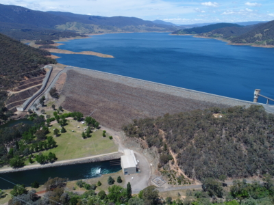
In October 2020, Diodrone presented at ANCOLD 2020 Online. Our paper titled,…

Read more
DSCF4198
  • All
  • Imaging
  • Inspection
  • Road

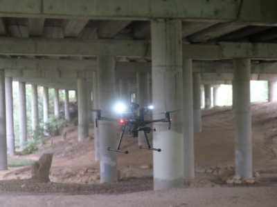
Close Visual Imaging for Bridge Inspection of Motorway Underdeck

November 19, 2020

Drone-based Close visual inspection of underdeck areas for Level 2 Inspection of…

Read more
Make an Enquiry
© Diospatial 2023
info@diospatial.com.au
  • Linkedin
  • Youtube
Digerati Solutions