Inspection of water supply pipeline
High detail Reality Capture over 5km of water supply pipeline using drone lidar and photogrammetry for digital condition assessment
PROJECT OVERVIEW
Avon Dam supplies water to the Illawarra region via one of two pipelines, depending on reservoir levels. The secondary pipeline, delivering pumped water from the eastern side of Lake Avon, required condition assessment as part of routine asset management. The pipeline travels above ground for almost 5km, where it traverses a rugged hillside and crosses several gullies via elevated bridge sections. Limited vehicular access to the elevated sections of pipeline, and the remote nature of the site, made conventional pipeline inspection difficult and potentially dangerous.
PROJECT SCOPE
DIODRONE SOLUTION
Diodrone developed a reality capture solution to provide engineers with a high-resolution digital twin and topographic survey of the pipeline.
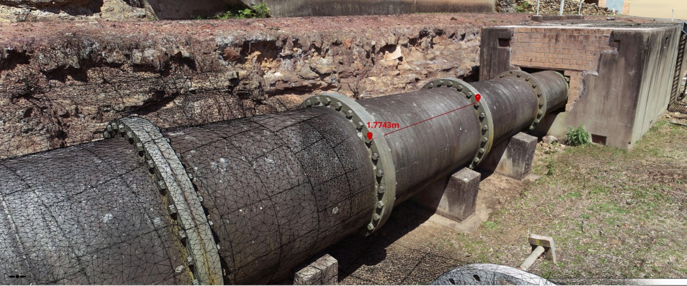
Inspection of the pipeline was achieved through delivery of a scale accurate and photorealistic 3D model, which enabled identification and measurement of defects in a remote and digital workspace. Additionally, a high-resolution LiDAR survey of the alignment, provided a digital topographic survey, which enabled identification and mapping of areas of erosion and other geotechnical risks which may affect the integrity and availability of the asset.
The use of drone-based reality capture eliminated the need for working at heights and provided a robust data set for the digital condition assessment and remediation of the pipeline.


